Scientific-Technical Reports

Soil related documents, Research Reports and JRC Scientific - Technical Reports available from Staff of the SOIL Team in the Land Resource Management Unit.

Filters

Go Back To

All Documents

Displaying 1 - 25 of 122 | Show 25 | 50 | All results per page.
EUSO annual bulletin 2023
Resource Type: Documents, Scientific-Technical Reports, Maps & Documents
Year: 2024

Healthy soils are essential for achieving climate neutrality and providing healthy food. The publication of the EU Soil Strategy for 2030 and the proposed Soil Monitoring Law marked a major milestone for soil protection in the EU. It also highlighted the importance of the EU Soil Observatory (EUSO) as the principal provider of soil-related data and knowledge at EU-level. The present report highlights the main activities of the EUSO in 2023. Through its activities in 2023, the EUSO provided policy support to a wide range of policy areas, including the proposed Soil Monitoring Law. The EUSO also launched the EU Soil Health Dashboard, a comprehensive and easy understandable monitor of the state of soil health in the EU. Furthermore, in 2023, the EUSO contributed to sharing data and knowledge about EU soils, supported soil research and innovation, and supported citizen engagements regarding soil matters. The activities of the Working Groups in 2023, a key element of the EUSO, included providing policy support, advancing scientific knowledge, and stimulating the integration of data. The present report also summarizes the EUSO’s activities planned in 2024. The EUSO will continue to provide policy support, e.g. on soil health assessment and soil monitoring. The EUSO Soil Health Dashboard will be updated with new available data and functionalities. In addition, the EUSO will continue to collaborate with Mission Soil research and innovation projects and continue to raise soil awareness among citizens.


Clay mineral inventory in soils of Europe based on LUCAS 2015 survey soil samples
Resource Type: Maps & Documents, Documents, Scientific-Technical Reports
Year: 2024

Clay minerals are a key factor in mineral soils as they are controlling physic, chemical and biological soil properties. The X-ray diffraction (XRD) analysis has been widely used to identify and quantify minerals in earth science The aim of this research is to describe the clay minerals in soils of Europe and United Kingdom by using soil samples from the Land Use/Cover Area Frame Survey (LUCAS) topsoil database sampled in 2015. A subset of 388 soil samples were selected from LUCAS 2015 topsoil survey. The clay fraction (<2 µm) was separated by sedimentation in distilled water. X-ray powder diffraction (XRPD) measurements have been carried out with a Siemens D5000 diffractometer with a graphite monochromator, using CuKα radiation at 40 kV and 40 mA. Clay mineralogy has been studied by measurement of basal spacing parameters on the clay fraction oriented in glass slides: 3 to 13 °2θ range 0.02 °2θ step size. The study involved the measurement of the 1. air-dried sample, 2. ethylene glycol solvated sample, 3. heat treatment at 110, 350 and 550 °C. Identification of clay minerals were based on the d-spacing value of their 00l (mainly 001) reflections after different diagnostic treatment. The semiquantitative composition of <2 µm fractions was estimated by using integrated areas of 00l reflections. Brief description of the clay mineralogy of all samples and semi quantitative mineral composition was performed at country level. The X-ray diffractograms after the different treatment (black = untreated, blue = ethylene glycol solvated, green = 110 °C, dark red = 350 °C, red = 550 °C) for each soil sample were analyzed. Majority clay minerals were compared to soils properties such as CEC, soil pH, soil organic carbon (SOC), and clay and sand content. Current descriptive analysis can be used to identify the most relevant clay minerals in soils of Europe. Monitoring over time can be used as soil health indicator to establish potential correlations between clay minerals and relevant threats as soil degradation, soil erosion, and soil pollution.

Download PDF: Clay mineral inventory in soils of Europe based on LUCAS 2015 survey soil samples

EUSO Annual Bulletin - 2022
Resource Type: Maps & Documents, Documents, Scientific-Technical Reports
Year: 2023
Publisher: Publications Office of European Union
Attachments: PDF icon JRC133346.pdf

This report presents the activities of the EU Soil Observatory (EUSO) that took place during 2021. Through its five main objectives, the EUSO contributes to improving the monitoring of soils, to creating and sharing knowledge and data about EU soils, in particular producing tailored outputs in support of policy development and to the wider public. These activities feed into the overarching knowledge management objective under which the EUSO provided extensive policy support to a range of policy areas, notably the upcoming Soil Health Law and the Horizon Europe’s Soil Mission.

A key element of the EU Soil Observatory are the six EUSO Working Groups (WG) that aim to discuss policy or technical advances on a particular topic. Their activities in 2022 were diverse and ranged from providing policy support (Soil Monitoring, Soil Pollution WGs), technical progress on integration of soil data (Soil Data WG) or advancing scientific knowledge about soils (Soil Erosion WG).

This report also highlights the developments to be expected in 2023. In particular, the EUSO will produce reports on soil pollution, soil organic carbon trends, pesticides in soils, land degradation and a soil fertility index and work on the state of soil health in the EU. A key development will be the publication of the EUSO soil health dashboard. The EUSO will support dedicated Soil Mission research projects and will continue to provide support for the upcoming Soil Health Law proposal. The EUSO is also planning a 2023 EU Soil Week.

Link: https://esdac.jrc.ec.europa.eu/public_path//shared_folder/doc_pub/JRC133346.pdf

Pesticides residues in European agricultural soils
Resource Type: Maps & Documents, Documents, Scientific-Technical Reports
Year: 2023
In the past 20 years, the use of pesticides in agricultural lands have been target of several European Union (EU) regulations. More recently, and in line with several EU sustainability goals, the use of pesticides has been targeted by relevant policy ambitions aiming to reduce their use and risk following health and environmental concerns. Nonetheless, the current knowledge on soil contamination by pesticides residues is limited, due to a lack of systematic soil monitoring studies addressing soil pollution, especially at EU scale.
 
To fulfil this knowledge gap, the EU Soil Observatory led a study targeting residues of active ingredients of pesticides used as crop protection products in soil samples collected from the 2018 LUCAS survey. This is the largest study providing a comprehensive characterisation on the extent of residues of active ingredients from pesticides in the soils of the EU. This work establishes an initial EU baseline, and project a future assessment of the effectiveness of EU policies and regulations targeting pesticides use and soil pollution. Moreover, this study provides the first steps on the development of risk indicators for soil, allowing to present the first temporal assessment of pesticides in EU soils following a pilot study with samples from 2015 LUCAS survey.
 
This study highlights that pesticide residues in soils are widespread in the European agricultural land (74.5% sites), whereas most of the sites (57.1%) present mixtures of substances (two or more). Additionally, an indicator of the ecotoxicological impact for soil organisms was developed. This indicator compared the concentration of these substances with the no effect concentration (NOEC)
for soil organisms, identifying areas at higher risk (1.7% sites). But also, allowed to estimate an increase in ecotoxicological risk when compared with a previous assessment (2015-2018). Finally, among the substances found was also possible to identify banned and non-approved substances in soils (12%), according to the 2018 regulations (Regulation 1107/2009),The current study brought by the EU Soil Observatory and LUCAS 2018 soil module provides a significant contribution to the status of current knowledge on soil pollution in the EU. The insights provided in this report may help identifying target policies in creating a toxic-free environment.
 
Go to the report.
LUCAS 2018 Soil Module
Resource Type: Maps & Documents, Documents, Scientific-Technical Reports
Year: 2022

This report accompanies the release of the soil dataset collected as part of the 2018 Land Use/Cover Area frame statistical Survey’ (generally referred to as LUCAS Soil). It presents an overview of the laboratory analysis data and provides a detailed description of the results for the European Union (EU) and the United Kingdom as it was still a Member State at the time of the survey. The report describes the spatial variability of soil properties by land cover (LC) class and a comparative analysis of the soil properties for NUTS 2 regions.

Regular monitoring provides a unique perspective on pressures affecting soils. In this respect, the soil module of LUCAS supports the specific needs of the European Commission by collecting data that characterises soil condition and health, which can be affected in relation to land use practices and other activities that are driven by specific policy instruments.
The LUCAS Soil module is the only mechanism that currently provides a harmonised and regular collection of soil data for the entire territory of the EU, addressing all major land cover types simultaneously, in a single sampling period (April – October).
At the same time, the LUCAS Soil module can support further policy needs through a flexibility that permits both the collection of new field data, if required, from new sampling sites. In turn, this can be complemented with additional laboratory analysis (e.g. micronutrients, specific pollutants). This capacity addresses the needs of a diverse policy user base and an evolving policy landscape.
The drive to collect soil samples under the umbrella of LUCAS was led initially by DG Environment, who provided funding for the 2009 survey to collect a baseline dataset on a range of soil characteristics such as organic matter content, nutrient status, fertility, acidification and soil pollution (metals). At that time, the main LUCAS survey was planned for 23 EU Member States (MS). Bulgaria and Romania were added in 2012 while Croatia, Cyprus and Malta were formally included in 2015. In the 2018 survey, all 28 MS at the time were included.
The initial premise was developed to collect samples from a depth of 20 cm following a common sampling procedure from 10% of the sites where field visits were to be carried out as part of the main LUCAS survey. In 2009, this gave around 235,000 possible locations for a nominal target of 23,500 soil samples. At the end of the survey, about 20,000 had been collected. These samples were analysed according to standard analytical methods in a single laboratory for a range of physical and chemical properties. In addition, visible and near-infrared spectra were acquired for all samples. The process was repeated in 2012 for Bulgaria and Romania, where samples were collected from about 2,000 locations. In total, 22,003 samples were analysed for 2009/2012.
In 2015, 90% of the locations sampled in 2009 and 2012 were maintained with the remaining 10% being substituted by new locations, including points at altitudes above 1,000 m, which were out of scope of the earlier surveys. In total, 21,859 samples were collected, of which 4,246 were at new locations compared with the 2009/2012 campaign. In addition, the soil module was extended by the JRC Enlargement and Integration Programme to Albania, Bosnia and Herzegovina, Croatia, Montenegro, North Macedonia, and Serbia (1,015 samples were eventually collected). Switzerland also participated following standard LUCAS protocols (150 samples were collected by Agroscope).
For 2018, 27,069 locations were identified for soil sampling. A soil related activity (i.e. assessing type of erosion, organic soil check sample collection) was made at 19,345 locations (LUCAS Grid Points). After the removal of samples that could not be identified or were mislabelled or lost in transit, the LUCAS 2018 Soil Module dataset contains data for 18,984 locations.
EU Soil Observatory 2021
Resource Type: Documents, Scientific-Technical Reports, Maps & Documents
Year: 2022

The scope of this document is to provide a synthesis of the achievements of the EU Soil Observatory (EUSO) during its first year of existence. The EUSO aims to become the principal provider of reference data and knowledge at EU-level for all matters relating to soil. The EUSO will be a dynamic and inclusive platform that supports EU soil-related policymaking by providing its stakeholder base with the knowledge and data flows needed to safeguard and restore soils.
Since its launch on December 4th 2020, most efforts have focused on defining and developing concepts associated with the main tasks of the Observatory (monitoring, dashboard, support to R&I, citizen engagement). Efforts have also been made to consolidate and enhance the capacity and functionality of the European Soil Data Centre (ESDAC), which is at the heart of the Observatory.
Major developments for 2021 included the establishment of an interservice Steering Committee (chaired by the Director of JRC Sustainable Resources Directorate), the support to the EU Mission “A Soil Deal for Europe", the development of the knowledge base on soil through research at the JRC, and the organisation of the 1st EUSO Stakeholder Forum.
The EUSO Stakeholder Forum was attended by over 1 000 participants over a three-day period in October 2021. In this sense, it succeeded in bringing a EUSO community together and in establishing a two-way dialogue with its user base. A summary of the event is presented in this report. EUSO activities will intensify in 2022.

Soil health in the Western Balkans
Resource Type: Documents, Scientific-Technical Reports, Maps & Documents
Year: 2022
Attachments: PDF icon KJNA31163ENN.en_.pdf
This study is a compilation of evidence to support the development of a soil component for a JRC Science for Policy Report on the “Status of Environment and Climate in the Western Balkans”1. This document attempts to benchmark a range of issues affecting soil health with considerations on the accession progress for an eventual Soil Health Law under the 2030 Soil Strategy.
The outcomes reported here are based on a literature review of 139 sources, bilateral exchanges with national soil experts in all Western Balkans countries, and on the personal experience of the authors. It should be emphasised that current data are scarce, and as such, the results should be considered as a primarily assessment and not definitive.
Based on the results of this study it is concluded that soil degradation is prevalent and extensive throughout the Western Balkans region. Soils are under pressure, but the intensity of various soil health indicators varies between them and among the countries. Climate change was not part of this study. Nevertheless, its impacts will be relevant in the coming decades, if not preventive mitigation, remediation, and adaptation actions will be needed to lessen their impacts.
Download the Report.
 
LANDSUPPORT Decision Support Systems: performance at EU, country, regional and local scale
Resource Type: Maps & Documents, Documents, Scientific-Technical Reports
Year: 2022

Developing a methodology for the analysis of the anthropogenic intervention on natural capital is an ambitious process. The LANDSUPPORT project implemented a Decision Support System (DSS) to help support better land use planning. The LANDSUPPORT DSS aimed at creating an innovative and intuitive environment that will improve the readability of measured and modelled geo-information, making it accessible to a wide range of stakeholders. A cross-evaluation analysis has been developed to measure the ability to support policy-related stakeholders and help them make informed decisions.

In the field of land use and land management, appropriate data are essential to support effective land planning in which different sources of available information need to be synthesised to provide an holistic picture of their combined effect. Policy stakeholders play a pivotal role in designing the DSS to be transversal and able to cope with issues at local, national and regional scales. National and regional land monitoring projects are often evenly disseminated or unsuitable for policy needs. Many attempts were recently made to overcome this problem, and the concept of decision dashboards is now extensively used to address these challenges. DSS are growing in popularity. They are often distributed as open access online interfaces that use georeferenced data and visualization tools to present model metrics and key performance indicators. Data behind DSSs can be static or dynamic as it is for the LANDSUPPORT DSS. The set of tools developed at different scales within different domains of application, are regularly updated and obtained from the state-of-the-art scientific development. With the user in mind, the LANDSUPPORT DSS encourages an extensive range of policy stakeholders to perform land use analysis, improving the tool's usability and making informed decisions for land sustainability. Decisions on land management at local scale are already benefiting from such information systems.

For the EU, specific tools were developed, tailored to the specific needs of stakeholders. For instance, in line with its strategic plan, Italy uses specific functionality and indicator sets to support its decision-making across agriculture sectors (viticulture and oliviculture tools are tailored examples of the DSS dynamism).
Another goal of DSS is to improve geodata integration across highly compartmentalized sectors. Each tool which appears in the dashboard will undergo regular improvements as the backend platform is refined. The LANDSUPPORT tool allows for the analysis of soil sealing in the land take tool, the land degradation neutrality tool (SDG 15.3.1 indicator), and the climate change resilience through another dedicated tool embedding future scenarios of climate change based on CORDEX ensemble models and (Representative Concentration Pathways, RCPs). Given the challenge of identifying and gaining access to good quality data from local partners, the LANDSUPPORT project fostered the capacity building among partners through workshops and other interactions and drew attention to better data management and improved accessibility and sharing. Embedding data access and its use in end-user organizations is vital to generating and sustaining interest in the dashboards.

This report presents the analysis carried out to test the LANDSUPPORT DSS’s ability to support EU policies when applied at the EU scale. Key EU policies of interest include the 7th Environmental Action Porgamme; COM 2006/231 Soil Strategy, Dir 2000/60/EC Water Directive; Dir 2007/2/EC INSPIRE Directive. and the land-related targets of the 2030 Sustainable Development Goals (SDGs) in particular, SDGs 2 “Zero Hunger”, 3 “god healh and well-being”, 13 “Climate action”, 15, with a special emphasis to the key SDG 15.3.1, “achieving a land degradation-neutral world” (LDN) and climate change (CC) mitigation goals.

Soil related indicators to support agro-environmental policies
Resource Type: Maps & Documents, Documents, Scientific-Technical Reports
Year: 2020

The presented datasets and indicators on soil erosion, soil organic carbon stocks and soil nutrients are the result of modelling activities taken place at the Joint Research Centre (JRC), Ispra. The datasets are important advancements in the current knowledge of soil properties and processes at continental scale. In addition, the soil erosion, soil carbon and soil nutrients datasets and indicators provide baselines for evaluating the current status of agricultural soils in the European Union (EU) and evaluating the impact of agro-environmental policies on land management. Moreover, those datasets can further contribute to propose and design management practices to improve the status of agricultural soils, face land degradation and better target policy interventions. The indicators of soil erosion and soil organic carbon are currently included in monitoring the Common Agricultural Policy (CAP) and the progress towards Sustainable Development Goals (SDGs). In addition, here we propose the development of soil nutrients datasets both as individual indicators (Phosphorus, Nitrogen, Potassium) and as composite indicator of soil fertility. Concluding, we found that the soil organic carbon changes cannot be identified within the timeline of policy interventions (for example in the CAP the assessment cycle is 7 years).

This document presents the latest status of soil condition in the European Union (EU), focusing particularly on agricultural land. The document presents the most recent assessment (2016) of soil erosion by water in the EU using the latest state-of-the-art data on management practices and the latest Land Use / Land Cover Area frame Survey (LUCAS). The assessment of soil organic carbon stocks and changes between the two LUCAS surveys (2009, 2015) (https://esdac.jrc.ec.europa.eu/projects/lucas) is addressed with a specific focus on agricultural land. Finally, the report proposes data sets and methods to assess the nutrient status of soils in the EU. To facilitate policy support, we have developed indicators (taking into account policy-relevant requests) based on aggregated data at regional scales (Nomenclature of Territorial Units for Statistics - NUTS2) that compare changes of soil condition in time. The report includes three sections relevant to the evaluation of soil condition and agri-environmental policies: (a) soil erosion, (b) carbon stocks and (c) soil nutrients. Both the key conclusions and the main findings (below) are grouped according to those three sections.

DOI: doi.org/10.2760/011194

JRC support to the European Joint Programme for soil (EJP SOIL)
Resource Type: Maps & Documents, Documents, Scientific-Technical Reports
Year: 2020
Attachments: PDF icon JRC support to EJP

DG AGRI is currently supporting under Horizon 2020 an European Joint Programming Initiative (JPI) on agricultural soil management to overcome current fragmentation in national research programmes and unleash the potential of agricultural soils to contribute to climate change mitigation/adaptation, while preserving or increasing agricultural functions. The EJP SOIL is a European Joint Programming Initiative co-funded by Member States on agricultural soil management contributing to key societal challenges including climate change and future food supply.

The EJP SOIL will look at how good agriculture soil management can contribute to food security, climate change mitigation/adaptation and ecosystem services through the preservation of soil organic content and water retaining capacity. This report provides technical advice and scientific guidance on the implementation of the EJP SOIL for an improved collaboration with JRC. The technical advice is a summary of the outputs of two meetings with the EJP SOIL partners in summer 2020. JRC also provides recommendations for a better collaboration in relation to the implementation of the LUCAS Soil Module, development of soil indicators and related data flows from EJP SOIL to ESDAC, development of the EU Soil Observatory plus some future research challenges. This report includes also the metadata related to datasets available at European scale for use by the EJP SOIL

Soil: how much do we value this critical resource?
Resource Type: Maps & Documents, Documents, Scientific-Technical Reports
Country: IT
Author: JRC’s NC-SOIL project
Year: 2018
Publisher: European Commission
Attachments: PDF icon JRC_highlights_eBook

Soil condition underpins food security, green growth, bioeconomies and aboveground biodiversity; it regulates climate, the hydrological and nutrient cycles, while  mitigating climate change. Soils provide resilience against floods and droughts, buffer the effects of pollutants and preserve cultural heritage. Healthy, functional soils underpin several targets of the Sustainable Development Goals.

Pressures on this finite, non-renewable resource, due to competition for land or inappropriate land management choices, severely impact soil functions. Amplified by climate change, these pressures lead to degradation processes such as erosion, contamination, loss of organic matter, shallow landsliding and, in extreme cases, a complete loss of the resource.

https://esdac.jrc.ec.europa.eu/public_path/shared_folder/doc_pub/JRC_Soil_Highlights_eBook_0.pdf


Progress in the management contaminated sites in Europe
Resource Type: Documents, Scientific-Technical Reports, Maps & Documents
Year: 2018
Attachments: PDF icon EUR29124.pdf

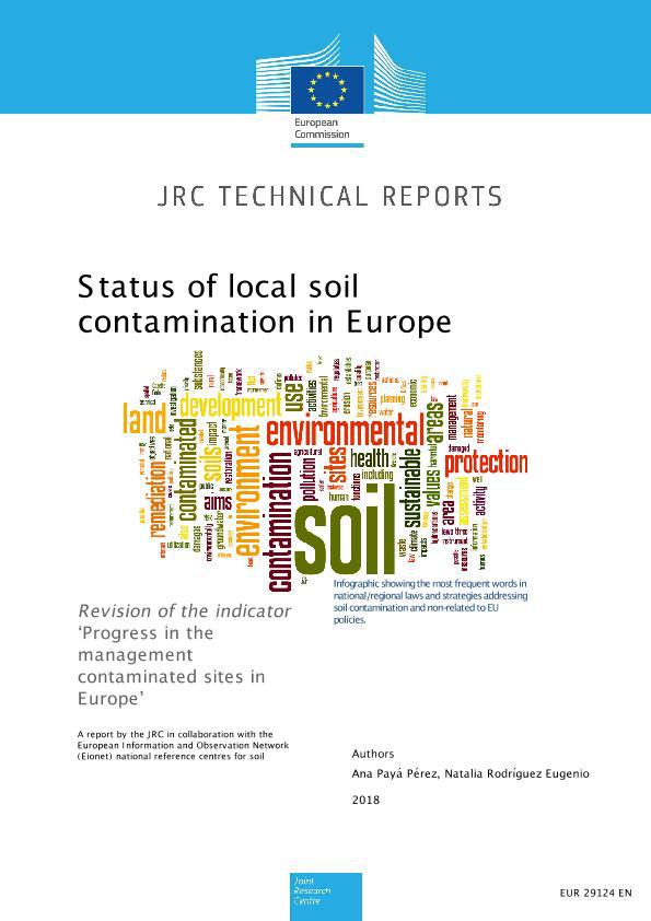
On this report the findings of the questionnaire commissioned by the European Commission Joint Research Centre for the revision of the Indicator "Progress in the management of contaminated site in Europe" in 2016 are presented. It has been produced with the contribution of data provided by the National Reference Centres (NRCs) in member states and cooperating countries within EIONET and funded by the country to work with the EEA and relevant European Topic Centres (ETCs) in specific thematic areas related to the EEA work programme


LUCAS 2018 - SOIL COMPONENT: Sampling Instructions for Surveyors
Resource Type: Maps & Documents, Documents, Scientific-Technical Reports
Country: LU
Author: FERNANDEZ UGALDE Oihane, ORGIAZZI Alberto, JONES Arwyn, LUGATO Emanuele, PANAGOS Panagiotis
Year: 2017
Publisher: Publications Office of the European Union
Language: en

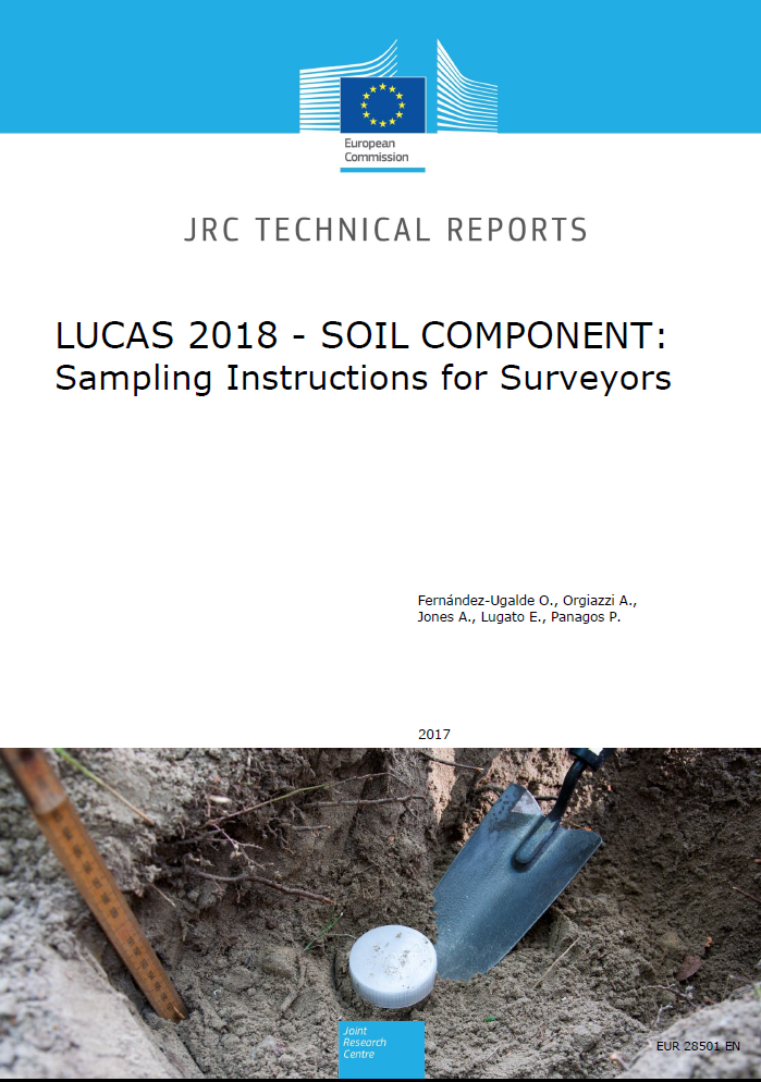
The European Commission launched a soil assessment component to the periodic LUCAS Land Use/Land Cover Area Frame Survey in 2009. Composite soil samples from 0-20-cm depth were taken, air-dried and sieved to 2 mm in order to analyse physical and chemical parameters of topsoil in 25 Member States (EU-27 except Bulgaria, Romania, Malta and Cyprus). The aim of the LUCAS Soil Component was to create a harmonised and comparable dataset of main properties of topsoil at the EU. The LUCAS Soil Component was extended to Bulgaria and Romania in 2012. Overall, ca. 22,000 soil samples were collected and analysed. All samples were analysed for percentage of coarse fragments, particle-size distribution, pH, organic carbon, carbonates, phosphorous, total nitrogen, extractable potassium, cation exchange capacity, multispectral properties and heavy metals. In 2015, the soil sampling was repeated in the same set of points of LUCAS 2009/2012 to monitor changes in topsoil physical and chemical parameters across the EU. The soil component was extended to points above elevations of 1000 m, which were not sampled in LUCAS 2009/2012. Furthermore, soil samples were taken in Albania, Bosnia-Herzegovina, Croatia, Macedonia, Montenegro, Serbia and Switzerland. The soil sampling was carried out following the instructions already used in LUCAS 2009/2012. Approximately 27,000 samples were collected and will be analysed during 2016 and 2017. In 2018, a new soil sampling campaign will be carried out within the LUCAS framework. Soil samples will be taken in repeated points of LUCAS 2009/2012 and LUCAS 2015. The novelty of the survey is that new physical, chemical and biological parameters will be analysed. Key parameters for evaluating soil quality, such as bulk density and soil biodiversity, will be analysed. These analyses require specific methods of soil sampling, preparation and storage of samples. Furthermore, field measurements such as the thickness of organic layer in peat soils, and visual assessment of signs of soil erosion will be carried out in 2018. This technical report compiles the instructions for collecting the various soil samples and for performing field measurements in the soil survey of 2018. These instructions will be used for all LUCAS surveyors, to create a comparable database of soil characteristics all over Europe.

Soil threats in Europe: Status, methods, drivers and effects on ecosystem services
Resource Type: Maps & Documents, Documents, Scientific-Technical Reports
Author: Jannes Stolte, Mehreteab Tesfai, Lillian Øygarden, Sigrun Kværnø (NIBIO), Jacob Keizer, Frank Verheijen (University of Aveiro), Panos Panagos, Cristiano Ballabio (JRC), Rudi Hessel (Alterra WUR)
Year: 2016

This report presents the result of WP2 of the RECARE project. One of the objectives of WP2 (Base for RECARE data collection and methods) is to provide an improved overview of existing information on soil threats and degradation at the European scale. The report is written by a group of experts from the RECARE team, coordinated by Bioforsk. In total, 60 persons were included in the process of writing, reviewing and editing the report. Eleven soil threats were identified for the report. These soil threats are soil erosion by water, soil erosion by wind, decline of organic matter (OM) in peat, decline of OM in minerals soils, soil compaction, soil sealing, soil contamination, soil salinization, desertification, flooding and landslides and decline in soil biodiversity.
Editors: Jannes Stolte, Mehreteab Tesfai, Lillian Øygarden, Sigrun Kværnø (NIBIO), Jacob Keizer, Frank Verheijen (University of Aveiro), Panos Panagos, Cristiano Ballabio (JRC), Rudi Hessel (Alterra WUR)
EUR27607

LUCAS Soil Component: proposal for analysing new physical, chemical and biological soil parameters
Resource Type: Maps & Documents, Documents, Scientific-Technical Reports
Author: Fernández-Ugalde O., Jones A., Tóth G., Orgiazzi A., Panagos P., Eiselt B.
Year: 2016
Publisher: European Commission, Joint Research Centre
Language: en
The European Commission launched a soil assessment component to the periodic LUCAS Land Use/Land Cover Area Frame Survey in 2009. In 2015, the Topsoil Survey was repeated in the same set of points of LUCAS 2009/2012 for monitoring changes in topsoil physical and chemical parameters across the EU. Currently, the European Commission is working on the organization of the upcoming LUCAS Soil Surveys (2018). This technical report is a proposal for analysing new physical, chemical and biological soil parameters within the forthcoming LUCAS Soil Surveys. Soil biodiversity is a key parameter that needs to be added to LUCAS Soil Surveys, due to the contribution of the soil biological community to soil functions such as food and biomass production, genetic pool for developing novel pharmaceuticals, and climate regulation. Among physical properties, bulk density is necessary to assess soil compaction and to estimate soil organic carbon stock in the EU. Field measurements such as signs of soil erosion and thickness of organic layer in Histosols is also important to assess two critical soil degradation processes in the EU: soil erosion and organic carbon decline due to land use changes and land take of Histosols. Finally, it could be interesting to organize a survey of soil profiles to collect information that will help to understand soil-forming processes and to evaluate soil ability for carbon sequestration, nutrient cycling, water storage, and contaminant filtering.
Extending Geographic and Thematic Range of SPADE/M with HYPRES Soil Profile Data
Resource Type: Scientific-Technical Reports
Year: 2015

Extending Geographic and Thematic Range of SPADE/M with HYPRES Soil Profile Data The measured soil profile data of the Hydraulic Properties of European Soils (HYPRES) were evaluated for their potential use in extending the geographic coverage and thematic range of the profiles of the Soil Profile Analytical Database of Europe of measured profiles (SPADE/M) database. The aim of increasing the number of measured profiles is to improve the definition of pedo-transfer rules (PTRs) to extend the range of parameters characterizing soils and the validation of model runs.The HYPRES and SPADE/M databases follow different concepts in the compilation of soil profiles. These differences were reflected in the organization of storing profile data in the databases. A specific conceptual problem to extending the SPADE/M data set is posed by recording repeated measurements in the HYPRES database for horizons of a profile and multiple profiles for a plot. The two data sets also differ with respect to the properties recorded, the measurement units and the database model. To increase the number of measured soil profile data of the SPADE/M data set with HYPRES profiles the data from the latter has to be standardized to be adjusted to comply with the specifications of the SPADE/M data set. The standardization process involves conversions of units or reference systems, such as the plot co-ordinate transformation or the extraction of properties from comment fields, but also conceptual adaptations of the method used to characterize a soil horizon in the database. The outcome of the standardization process is a series of soil profiles which can be seamlessly added to the SPADE/M data set. Author(s): R. Hiederer Luxembourg: Publications Office of the European Union 2011 – 43 pp. – EUR 26540 EN Scientific and Technical Research series – ISBN 78-92-79-21593-3(online), doi:10.2788/8209 Download report: (Size: 1 MB) Preview FrontPage : Last Update: 21/08/2014

Soil Resources of Mediterranean and Caucasus Countries
Resource Type: Scientific-Technical Reports
Year: 2015

Soil Resources of Mediterranean and Caucasus Countries This book is result of the workshop on "Extension of the European Soil Database" held in Izmir/Turkey on 14-15 May 2012. The country reports on the status of soil mapping and the development of national soil information systems were presented briefly and discussed in relation to the objective on extension of the European soil database and information system. The most recent extension studies cover Algeria, Armenia, Azerbaijan Cyprus, Egypt, Georgia, Iraq, Israel, Jordan, Lebanon, Libya, Malta, Morocco, Palestine, Syria, Tunisia, and Turkey this book features country chapters, with contributions from 13 of the above-mentioned countries. Editors(s) Yusuf Yigini, Panos Panagos, Luca Montanarella. Special thanks to the contributors: H. Ghazaryan (Armenia), A. Ismayilov (Azerbaijan), Z. Zomeni, A. Bruggeman (Cuprus), M.M. Kotb (Egypt), T.F. Urushadze, G.O. Ghambashidze (Georgia), A. Salih Mhaimeed (Iraq), O. Crouvi, R. Zaidenberg, M. Shapiro (Israel), M. H Al Ferihat (Jordan), T. Darwish (Lebanon), B. Nwer(Libya), Malta Environment and Planning Authority (Malta), B. Dudeen, W0 Abu Rmailah, M. Alsalimiya, M. Alamleh (Palestine), S. Senol, I. Bayramin (Turkey). – Luxembourg: Publications Office of the European Union – 2013 – 243pp. – EUR25988EN Scientific and Technical Research series, SSN 1831-9424, ISBN 978-92-79-30346-3, doi: 10.2788/91322 Download report: (Size: 17 MB) Preview FrontPage : Last Update: 03/06/2013

The unofficial guide for authors
Resource Type: Scientific-Technical Reports
Year: 2015

The unofficial guide for authors The unofficial guide for authors(or how to produce research articles worth citing) Tomislav Hengl and Mike Gould, EUR 22191 EN, 66pp. Office for Official Publications of the European Communities, Luxembourg. Download report: (Size: 1.6 MB) Preview FrontPage :

Euro soils: Identification, collection, Treatment and Characterization.
Resource Type: Scientific-Technical Reports
Year: 2015

Euro soils: Identification, collection, Treatment and Characterization. Methodological Aspects of Reference Soil Sampling. Field Work on euro-soils profile anaysis and sampling procedures. Pedological Characterization composition analysis. Determination of organochlorine compounds. Evaluation of Laboratory Ringtest . Kuhnt and Muntau. (1994). Euro soils: Identification, collection, Treatment and Characterization. EUR 19460 EN, 152pp. Keywords: Euro soils, Collection, Soil Sampling Download report: (Size: 1.6 MB) Preview FrontPage : Last Update: 11/02/2010

Soil geography and geostatistics (Concepts and Applications)
Resource Type: Scientific-Technical Reports
Year: 2015

Soil geography and geostatistics (Concepts and Applications) Geostatistics, which can be defined as the tools for studying and predicting the spatial structure of georeferenced variables, have been mainly used in soil science during the past two decades. Since now, hundreds of geostatistical papers have been published on soil science issues (see bibliography ibid., this volume).The use of geostatistical tools in soil science is diverse and extensive. It can be for studying and predicting soil contamination in industrial areas, for building agrochemical maps at the field level, or even to map physical and chemical soil properties for a global extent. The users of the output maps are going from soil scientists to environmental modelers. Krasilnikov, P., Carré, F. & Montanarella, L. (eds.). EUR 23290 EN, Catalogue number: LB-NA-23290-EN-C, ISBN 978-92-79-08720-2, ISSN 1018-5593 Luxembourg: Office for Official Publications of the European Communities , 2008. Download report: (Size: 5 MB) Preview FrontPage :

Background Guide for the Calculation of Land Carbon Stocks in the Biofuels Sustainability Scheme: Drawing on the 2006 IPCC Guidelines for National Greenhouse Gas Inventories
Resource Type: Scientific-Technical Reports
Year: 2015

Background Guide for the Calculation of Land Carbon Stocks in the Biofuels Sustainability Scheme: Drawing on the 2006 IPCC Guidelines for National Greenhouse Gas Inventories This Guide covers the calculation of carbon-stock changes in soil and above- and below-ground vegetation due to land use conversion in support of Directive 2009/28/EC on the promotion of the use of energy from renewable sources, particularly for assessing carbon-stock changes due to land conversion for biofuel production. The methodology put forward is based on the Tier 1 approach as developed under the IPCC Guidelines 2006. It is based on specifying default values for carbon stocks and using coefficients of divergence from the default values according to land use/cover. The methodological approach of the IPCC was adapted for use with spatial layers instead of data tables. The spatial layers of the factors influencing carbon-stock changes were generated with global coverage and thematically aligned to comply with stipulations made in the Directive. According to the types of land use/cover conversion, a review is made of the methodology of the IPCC (2006). Particular problems regarding peatlands are presented. Drained peatlands cannot be assessed in terms of carbon-stock changes because drainage occurs on the overall peat soil profile (not only on the first 30 cm). This has direct consequences not only on CO2 emissions but also on CH4 and N2O. Tables of coefficients of conversions are then proposed according to climate zone and continental boundaries for soil carbon-stock changes and for above- and below-ground carbon stock changes in biomass in a Technical Annex. Author(s): Florence Carré, Roland Hiederer, Viorel Blujdea, Renate Koeble, 2010 – 109 pp. – EUR 24573 EN– Scientific and Technical Research series – ISSN 1018-5593, ISBN 978-92-79-17455-1, Doi 10.2788/34463 Download report: (Size: 2.5 MB) Preview FrontPage : Last Update: 12/11/2010

Guidelines for the use of native mosses, transplanted mosses and soils in assessing organic and inorganic contaminant fallout
Resource Type: Scientific-Technical Reports
Year: 2015

Guidelines for the use of native mosses, transplanted mosses and soils in assessing organic and inorganic contaminant fallout These guidelines on the use of mosses are of strategic importance in that they make it possible to harmonize the indications obtained from differing environments in terms of extent and, thereby, to compare them with results obtained using other methods. Cenci, R. (2008). European Commission, Joint Research Centre, Ispra, EUR 23292-EN, 33 pp. ISBN: 978-92-79-08719-6, ISSN: 1018-5593 Key words: mosses, soils, dioxins, heavy metals, radioisotopes. Download report: (Size: 2.2 MB) Preview FrontPage : Linee guida per l' utilizzo di muschi indigeni, muschi trapiantati e suoli per valutare le ricadute di contaminanti organici e inorganici. Scaricare il documento: (Taglia: 2.2 MB)

Threats to the Soil Resource Base of Food Security in China and Europe
Resource Type: Scientific-Technical Reports
Year: 2015

Threats to the Soil Resource Base of Food Security in China and Europe To secure adequate food supply is the major challenge for humanity in the 21st century. Growing world population and its urbanization put pressure on this basic need, which is further threatened by the constant loss of fertile land. The assessment of sustainability of food supply under increasing pressure on land resources has been selected as one of the most important priority topics of the activities of Sino-EU Panel on Land and Soil (SEPLS). The Panel has performed a number of related researches and discussed the results on a scientific seminar in January 2012 in Nanjing, China. This report is an output of this seminar with a summary of the structured discussions on the below issues. Author(s) Gergely Tóth and Xiubin Li (eds.) – Luxembourg: Publications Office of the European Union – 2013 – 117pp. – EUR25632EN Scientific and Technical Research series, ISSN 1831-9424, doi:10.2788/71196 Download report: (Size: 4 MB) Preview FrontPage : Last Update: 10/09/2013

Soils of the European Union
Resource Type: Scientific-Technical Reports
Year: 2015

Soils of the European Union This report is based on the information contained in the European Soil Database, the result of more than ten years of fruitful effort and collaboration between the European Commission’s Joint Research Centre in Ispra, Italy, and Europe’s leading soil science institutions. The current report overviews soils of the European Union classified in a new standard which is the World Reference Base for Soil Resources (WRB; FAO 1998). This system originates from the approach of the FAO to correlate soil resources globally. The advantage of using the system of the FAO is that the soil resources of the European Union are integrated into the world-wide context. Gergely Tóth, Luca Montanarella, Vladimir Stolbovoy, Ferenc Máté, Katalin Bódis, Arwyn Jones, Panos Panagos and Marc Van Liedekerke (eds.). EUR 23439 EN, ISBN 978-92-79-09530-6, ISSN 1018-5593, DOI 10.2788/87029 . Luxembourg: Office for Official Publications of the European Communities , 2008. Download report: (Size: 4MB) Preview FrontPage :

European Soil Portal
Resource Type: Scientific-Technical Reports
Year: 2015

European Soil Portal The Official Guide for the European Soil Portal. References to Data, Documents, Applications, Projects, Themes and Utilities. Also, the features of the Soil portal are presented against the INSPIRE principles. EUR 22186 EN, 69pp. Office for Official Publications of the European Communities, Luxembourg. Panos Panagos, Marc Van Liedekerke and Luca Montanarella Download report: (Size: 11.2 MB) Preview FrontPage :