You are here
Proximal sensing, Drones & Soil
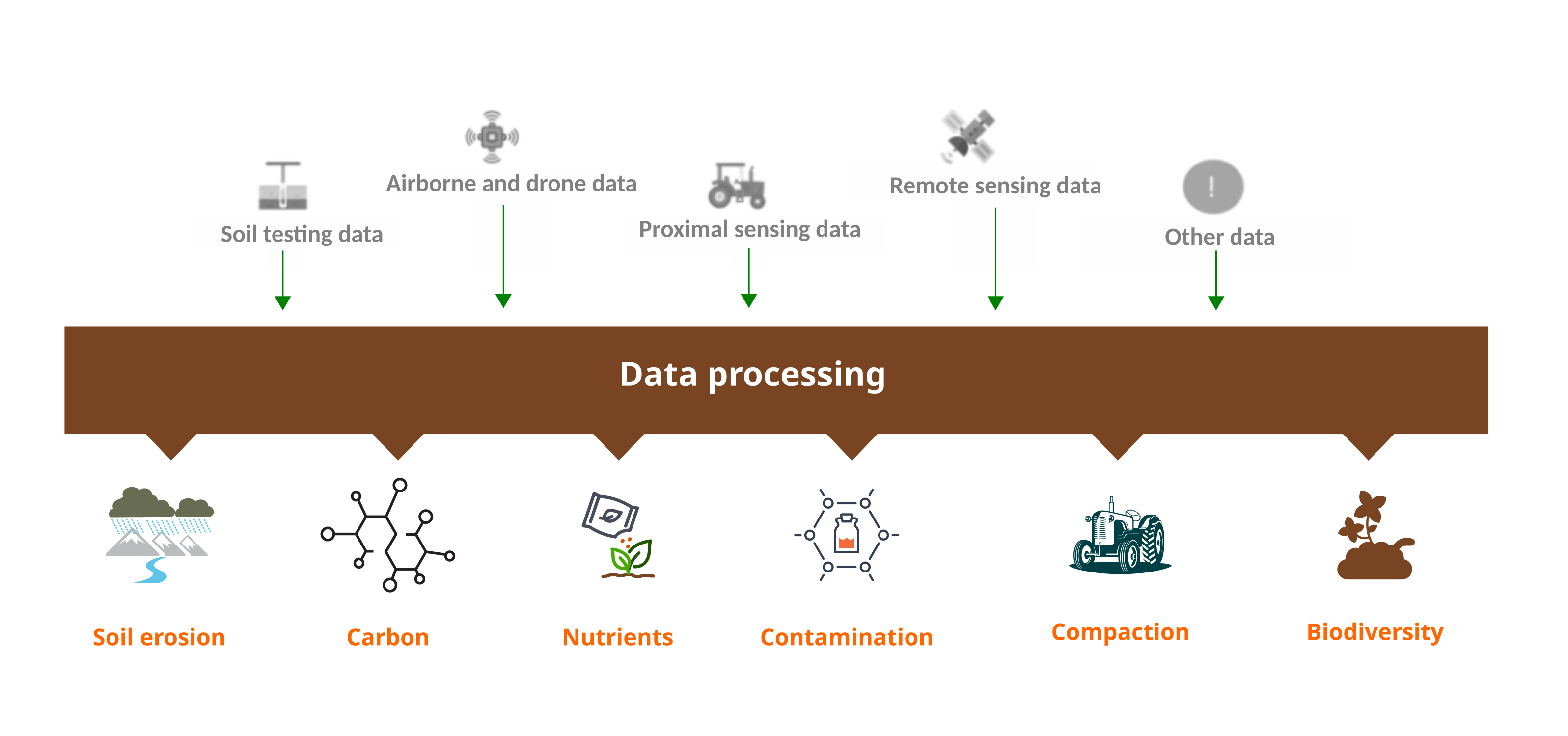
Proximal sensing
Proximal sensing of soils uses sensors placed close to or in direct contact with the soil to measure its properties. This method allows for in situ determination of various soil characteristics, such as physical, chemical, and biological properties. Such sensors may use optical, geophysical, electrochemical, and mechanical techniques to measure properties such as soil moisture, nutrient levels, pH, and soil texture.
These technologies are widely used in precision agriculture to optimize crop management, monitor soil health, and improve land management practices, soil contamination assessment and archaeological studies. Proximal sensing provides high-resolution data, enabling detailed soil mapping and real-time monitoring.
Drones
Drones have become valuable tools in agriculture, particularly for measuring and monitoring plant health. However, there is increasing realisation of their potential to provide detailed and contemporary assessments of soil health. In particular, drones equipped with multispectral scanners can help assess soil properties such as moisture content, organic matter, nutrient levels, soil texture, structure, and composition. These data can help farmers understand soil variability and manage their fields more effectively and aid the roll out of sustainable soil management practices.
By integrating drone data with other technologies such as precision agriculture, farmers can more precisely adapt inputs such as water, fertilisers, and pesticides. This will aid soil health while reducing pollution and costs. Drones can also identify areas of soil erosion and compaction, helping farmers take corrective actions to prevent further soil degradation.
Survey description
There is increasing realisation of the potential of sensors to assess soil properties such as moisture content, organic matter, nutrient levels, soil texture and soil structure. These data can help farmers and land managers to understand soil variability and manage their land more effectively, helping the roll out of sustainable soil management practices. Sensor data can help to monitor the state of soil health at local and regional scale, depending on the type of survey.
In spite of increased applications of sensors, there is still a lot of unexplored potential to use sensor-derived data for a more complete and cost-efficient monitoring of soil health. For example, the possible integration of data coming from sensors with other data streams (soil sampling surveys, etc.) is still unexplored. Within a policy context, sensor data can be relevant for: i.) monitoring the soil descriptors proposed in the EU Soil Monitoring Law, and ii.) the soil indicators in the EU Mission Soil Implementation Plan. Collecting information on studies using sensor data, and performing a meta-analysis of these studies, can help to advance soil data integration derived from sensor surveys.
Objectives:
- In a first step, make a database of research studies that have used sensors to collect soil data. Link to the survey: https://ec.europa.eu/eusurvey/runner/EUSO-Survey-Drones-ProximalSensor
- In a next step, perform a meta-analysis of these studies to explore the potential of these data flows.
- Then in a final step, investigate the potential of sensors in monitoring the soil descriptors proposed in the EU Soil Monitoring and Resilience Directive and the soil health indicators in the EU Mission Soil Implementation Plan.
- The outputs will contribute to the development of a report or scientific publication.
Please feel free to forward the survey (deadline for submissions 28.2.2025) to any colleague who perform research in this field.
Contact point: Nils BROOTHAERTS Nils (Nils.BROOTHAERTS add ec.europa.eu)