English-EN | Español-ES | Italiano-I | Ελληνικά-GR | Portuguese-PT
| |
DIS4ME | DIS4ME
Homepage | DESERTLINKS Homepage
| © DESERTLINKS 2004 English-EN | Español-ES | Italiano-I | Ελληνικά-GR | Portuguese-PT |
| Desertification Indicator System for Mediterranean Europe | ||
|
Changes
in the availability of water resources
Lead author: Anton Imeson 3DE@hetnet.nl With contributions from: Maria José Roxo and Pedro Cortesao Casimiro <mj.roxo@iol.pt>, Jorge García Gómez <jorgegg@um.es>, Giovanni Quaranta, Rosanna Salvia <quaranta@unibas.it>, Constantinos Kosmas <lsos2kok@aua.gr> g Description of reasons leading to changes in the availability of water and why they are an issue in the context of desertification Author: Anton Imeson 3DE@hetnet.nl A reduction in the availability of water resources is perhaps the first inevitable impact of desertification. Water is essential for agriculture, industry as well as public health and well-being. Ecosystems and economies are highly sensitive to changes in water availability. The amount of water available for groundwater recharge and storage in reservoirs is highly sensitive to small reductions in rainfall or increases in evapotranspiration. Consequently the quantity of available water varies greatly from year to year. Inevitably the demand for water is greater when water availability is low and there is always a pressure to overexploit water, treating it as a common good. Different crops and economic activities require critical amounts of water at critical times of the year with the result that land users soon feel the consequences of changes in water availability. Water availability can be estimated from hydrological data (groundwater levels and river discharges) at national and local levels and from information on water consumption. As well as being an issue for desertification, water availability is also an excellent indicator of desertification because the amount of water flowing in rivers or percolating to groundwater is strongly affected not only by climate but also by the way the land and water resources are managed. All kinds of land and soil degradation processes and changes can have negative or positive effects on the available water. Water availability integrates the effects of changes in the bio-physical system that affect the amount of water supplied to the socio-economic and cultural system that in turn affects the demand and needs. However, more than this, water performs critical functions in rivers, and a minimum baseflow is needed to maintain them. In nearly all areas of the world subject to desertification, river flows are steadily decreasing. Other reasons for the reduction of water availability in areas experiencing desertification are explained below. Climate. Small changes in precipitation influence water availability but this relationship is context dependent. Always an important consideration is the amount of rainfall used by evapotranspiration. Paradoxically, during some dry years there may be more water in rivers and a higher groundwater recharge simply because the vegetation grows less and uses less water. However, in other dry years this is not the case because water availability depends on the amount and duration of rainfall events. Relationships between precipitation and runoff should preferably be analysed using a water balance approach and the conclusions examined by a consultant hydrologist. Within basin variability. The impact of desertification on water availability varies within a drainage basin. For example on north facing slopes near Benidorm, Spain, it was found that water availability was uniform along an entire slope. On the south facing slopes the upper and middle sections had thin arid soils but these provided runoff and water to the soils at the foot of the slope. Higher temperatures. Higher temperatures are correlated with higher potential and actual evaporative losses so that the impact on desertification is more straightforward. However, when temperature is a factor limiting plant growth or biological activity an increase in temperature also means that more water is used by ecosystem processes, which leaves less water for human requirements. Examples of these effects can be demonstrated in the DESERTLINKS Target Areas. In Portugal and Spain it has been demonstrated that the first effective autumn rainfall occurs one month later than 100 years ago, and that in the Alentejo, Portugal, the amount of rainfall occurring during the critical months of March and April has become less during the last few decades. In Spain the July soil temperature at 5 cm depth is ten degrees cooler during humid years than during dry ones. Water availability to plants and ecosystems. Water availability strongly controls the amount of primary production in areas where plant growth is limited by water. When this is the case, any change in the amount and/or the timing of rainfall might reduce the availability of water to plants or ecosystems at critical periods. The availability of water provided by rainfall for crops (or for any ecosystem function) must match the requirements of the crop (or function), particularly during periods of growth when many crops are sensitive to moisture stress. Secondly, hotter weather means that many plants require more water for transpiration. Conversely, more precipitation means that evaporation keeps the soil cooler and reduces the water requirements. Thirdly, only rainfall above a minimum amount contributes to the water resources of an ecosystem. Rainfall amounts below a threshold of 3 to 5 mm are lost to evaporation. As climates become more arid, so the amount and duration of rainfall events decrease, and in this way water resource available for plants are reduced. Changes in land use. Changes in land use have a strong impact on water availability. Each land use type has its own water use profile. Consider the major land use types.
The availability of water resources is an issue because it is directly linked to the ecological and economic productivity, the perceptions of how lifestyle aspirations are being met, hygiene and health. Changes in the availability of water resources can lead to land abandonment and be a factor that contributes to the migration of citizens to urban areas. Changes in water availability result in a new situation in which there is less water available for traditional land uses and more for irrigated agriculture, as this generates more income and jobs. g Examples of reasons for changes the availability of water in Mediterranean areas g
Lower Inner Alentejo, Portugal The majority of the Mértola municipality territory is part of the Guadiana river basin, in its downstream sector, with altitudes ranging from 200 metres to sea level near Vila Real de Santo António. The Guadiana basin has an overall surface of 66800 km², of which 11580 km² (17%) are in Portugal, where the river runs for 260 km. In Portugal, this river basin presents an elongated and narrow shape, with a general north-south orientation, limited to the north by the Tejo river basin, by the Atlantic Ocean to the south, by the Spanish border to the east and by the Tejo, Sado and Mira basins on the west. The existing morphostructural elements are part of the Hercinian massif: vast flat surfaces (peneplain) interrupted only by structural landforms or more resistant differential erosion landforms, like the Adiça and Alcaria Ruiva hills. In Mértola, the Guadiana river basin lies on the Hercinian subtract of metamorphic rocks, partially covered by tertiary and quaternary continental deposits. Therefore, soils are essentially derived from schist and other, mostly impermeable, metamorphic rocks. The soils are generally very shallow, presenting common and frequent land use problems due to their clayey composition and extremely low organic matter content. The physical and chemical properties of these soils do not favour rainfall infiltration, resulting in very limited and extremely localised ground water resources. The drainage network is very dense, the configuration resulting directly from the lithology type (metamorphic / eruptive rocks). Slope profiles are, in general, convex-rectilinear-concave or convex-concave, producing a rolling landscape with iso-altitude of the summits. Valleys of the major Guadiana tributaries are much incised near the local base level, most of the time following structural weaknesses (faults and fractures). Alluvial valley bottoms are extremely scarce, resulting in an almost non-existent proportion of alluvial soils with agricultural capacity. Climatically, the Guadiana river basin is rather homogeneous, with Mediterranean continental characteristics; very hot dry summers, very high insolation and evapotranspiration and strong annual thermal amplitudes. The irregularity of the rainfall regime is another main characteristic of this type of climate, which substantiates and reflects directly on the drainage regime. Consequently annual runoff is highly irregular (variation coefficient from 0.75 to 0.90), 80% of it falling in the period October to March. Even during average years, almost all water channels have no runoff at all.
The annual flow, generated in the whole of the Guadiana river basin, averages 6700 Hm³, of which 1820 Hm³/Year are generated in Portugal (4900 Hm³/Year from Spain). With an increased use upstream, the flow coming from Spain is lowered to around 2680 Hm³/Year (55 %), and projections point to only 2135 Hm³/Year (44 %) in the very near future. Although the surface and groundwater resources are interconnected and interdependent, their interaction in the Portuguese section of the Guadiana river basin is extremely low, due to the minimal extension and productivity of the aquifers. Nonetheless, within a context of scarce water resources, groundwater has an exceptional importance, as this is the main source for public water supply and some, very few, agricultural activities (mostly cattle). Yet, these waters are known to have deficient physical and chemical qualities, and consequently have a very limited use for human consumption, due to the high degree of mineralisation. These waters are fundamentally sodium chloride-rich, in the pyrites band, with bicarbonate and alternatively chlorides or sodium in the south part of the municipality. Several studies refer to an increase in soil salinization, as a consequence of aquifer over-exploitation, for irrigation of orchards and cultivated pastures.
It is important to mention that drought situations are extremely common in the Guadiana basin, which in turn increase the groundwater exploitation, and are responsible for large losses in agricultural activities, that constitute most of the economic activity in the basin (see description in economic activity). An interesting aspect is that farmers, to tackle scarcity of water resources, have been building very small dams to provide drinking water for cattle, as well as to irrigate very small areas. According to Landsat imagery, processed and analyzed for 1985 and 2001, there is a significant increase in water pixels (30X30 meters), 6860 in 1985 and 11716 in 2001, and an increase from 243 water patches to 312 (Casimiro 2002). As a consequence of the climatic characteristics of the Guadiana river basin, along with the dominant land uses and dynamics, water quality is clearly deficient. A very strong seasonal regime, without any flow during summer (and sometimes none in late spring and early autumn), associated with very high temperatures and significant pollution discharges from agricultural and food industry, leads to frequent eutrophication situations, with consequent death of aquatic fauna. The low quality of water is also a consequence of the high sediment content, resulting from the action of intense water erosion of the soils. Agricultural practices and cultures not adapted to the climatic and soil conditions are the factors responsible for this situation (see the section on land degradation). g Spain The main issues affecting water availability in the Guadalentín valley are related to climatic conditions and changes in land uses.
The other main land use change is the development of tourism, mainly in coastal areas. This, apart from involving important socio-economic changes (see Desertification issues: Littoralisation and Desertification issues: Changes in economic activities) means increasing water demands. Population increase, golf courses, and new services put more pressure on water resources and sometimes such pressures are forcing the translocation of resources from agriculture to the service sector.
The main problem associated with these activities is the present overexploitation of the aquifers and the salinization of soils due to the use of inappropriate water in traditionally dry farming soils, some of them not suitable for irrigated farming activities. The disappearance of traditional less competitive farms is also a consequence of the scarcity of water, since water is a limiting factor for this activity. Reference
g
Agri Basin, Italy The Agri Basin presents a cool temperate Mediterranean climate, with strong differences between the coastline and the inland mountains. The inland countryside has a cooler climate and in the summertime the rainfall is above 150 mm, while on the coastline, in the same period, the rainfall is less than 100 mm. In addition, summer is characterised by a strong drought and a mean monthly temperature of more than 23°C, in the warmest months.
In recent years, a considerable reduction of winter and autumn rainfall has caused a serious deficit of water resources. This problem especially affects the agricultural sector, which accounts for up to 70% of total water resource use.
For the whole Basilicata Region it has been estimated that the lack of water for the agriculture sector is around 70 Mcm and that the total irrigated area in the Agri Basin is 14,959 hectares (Istat, 2000). The drought effects are strongly aggravated by an inefficient management of water resources that has heavily reduced its availability. To the reduction of the water availability is added the tendency towards increase in demand for water from the other productive sectors. In particular there is the tourist sector, with the construction of an increasing number of villages and resorts, that represent the greatest competitor to the agricultural sector, because it increases the need for water in summer, the period of greater water stress.
The agricultural sector has increased its demand for water for two reasons. Firstly crops that were not traditionally irrigated previously, now are. Secondly, because of changes in meteorological conditions the irrigated season has increased to cover not only the summer, but also the autumn. Work with the stakeholders carried out under the auspices of the DESERTLINKS project through the stakeholder workshops has underlined the fact that reduced availability of water for the agricultural sector has started to be taken into account in farming decisions. It has been observed that greater attention is being given both to growing crops that have lower irrigation requirements and to cultivars that have an early growing season, thus escaping the drought period.
The reduction in water availability is also leading to the adoption of more sustainable techniques of cultivation. Arboreal cover crops are, for instance, only rarely used; mainly because farmers fear the competition for water consumption between cultivated plants and the grass used as a cover crop. g Lesvos,
Greece Lesvos is a part of the Aegean islands
water sector, one of 14 water sectors into which Greece is divided. This
sector is poorest in water resources of all the sectors. The total potential
water resources are estimated at about 1,000,000,000 m³/yr by the
Ministry of Industry, Energy and Technology, (CPER, 1989). Lesvos is the
largest of the Aegean islands, and thus it should contribute a significant
part to the above estimate. The fragmentation and overlapping of water resources management responsibilities among a large number of governmental agencies in Greece seems to hinder any similar responsibilities on Lesvos. In addition, the centrality of the decision making process may compound the local authority's efforts, by creating delays in planning and implementation. Thus, the timely implementation of a total water resources management framework for the island seems essential for any future water resources development. The estimates for total water use in the Aegean islands sector indicate that agriculture accounts for about 70% of use, domestic water supply for about 29%, and energy/industry for only about 1%. It is considered that water use on Lesvos should fall within such limits, however this needs further investigation. The coastal waters are primarily devoted to tourism. Fisheries and industry share the coasts in the gulfs of Kalloni and Gera. The quality of the water is generally considered excellent (Eressos), but pollution exists in some areas (Gera). As in the whole of Greece, legislation for the protection of the environment is incremental. The lower Kalloni part of the lowland is a valuable wetland for protection of rare birds. It has been incorporated into NATURA and projects are expected to be funded for protection of the area.
The following actions should be considered most critical for a total water resource management framework on the island of Lesvos.
By the application of a somewhat simplistic
type of analysis, using the rational method, it is estimated that the
total available annual surface runoff for the whole island of Lesvos is
300,000,000 m³. To obtain this estimate a runoff value of 180 mm
was used, averaged for the whole island. However, more detailed computations
may be made for each of the major watersheds, given the prevailing geological
formations and their geographical location. Hence, the Euergetoulias river
watershed in the eastern part of the island, with predominantly permeable
strata (limestone, dolomites etc.) and an area at 90 km², would have
a total annual average surface runoff of 9,700,000 m³. The western part of the island, with
an average annual rainfall of 415 mm, has higher volumes of surface water
runoff compared with the apparently more humid eastern part which has
725 mm of rainfall. The higher runoff rates in the western part can be
explained by the following:
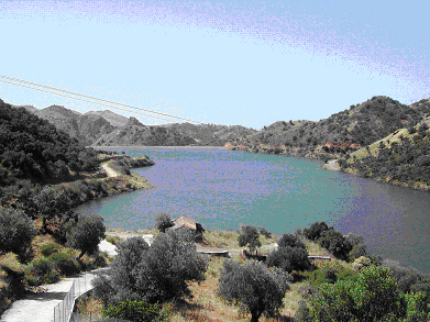
The Eressos dam. The western part of Lesvos is arid and rocky with poor vegetation. This contrasts with the humid and more fertile eastern part of the island that is almost fully covered by forests or olive groves. The distinction between the arid west and the wet fertile east is the predominant element that characterises the water resources potential, the hydrological parameters and consequently the environmental conditions and the economic development of the island. Apart from the climate difference, the division is based primarily on the geology of the two parts and secondly on possible man-made interventions in the western part. Considering the high water demands for human consumption and irrigation of agricultural crops and the recent flooding of the plain area the Eressos, a reservoir has been constructed at the lower part of the watershed of the Calandra creek.
The operational water storage capacity of the reservoir is 2,550,000 m³ with a maximum storage capacity of 2,760,000 m³. It is charged by the water from the upstream watershed, covering an area of 26.7 km². A collective infrastructure has been constructed for irrigation in the area; many farmers irrigate their fields using private wells and drills. The underground water potential of the plain is not sufficient to cover the needs. As a consequence of the shortage of water and the lack of infrastructure, irrigation is insufficient and usually with poor quality of water. The reservoir irrigates the plain area, which covers 377.4 ha. The irrigation infrastructure is expected to be expanded in the surrounding hilly area of 404.3 ha. Water will be pumped into an upper area and then it will be distributed to the farmers through a network of underground pipelines. High amounts of water runoff, in the form of flooding, occur during rainfall events due to poor vegetation cover, steep slopes, shallow soils and the relatively impermeable igneous rocks present in the Calandra watershed. Based on the existing climatic and soil conditions, it is estimated that a rate of water flow of 93,000,000 m³/sec will occur with a recurrence interval of 5 years into the reservoir. Annual water runoff is estimated at 224 mm. The total volume of water transported to the reservoir is expected to be 5,981,000 m³, which is about half the maximum storage capacity of the reservoir. It is expected that 42.6% of the total annual discharge of the creek will be stored in the reservoir, protecting the lower plain area from flooding. The level of flood protection will be significant, since the drainage area of the reservoir accounts for 45% of the drainage area of the creek. The creek upstream of the reservoir normally has surface flow from December to May. Significant environmental impacts from the construction of the reservoir are not expected due to the medium size of the project. Furthermore, all the negative consequences to the human and natural environment have been taken into consideration during the planning of the project. g Overview
of how the indicators inter-relate The indicators fall into several categories. Firstly there are those that are based on the state of groundwater resources in drainage basins. The indicators aim to show whether the resources are over-exploited. Exploitation can also be measured according to whether or not water has to be imported into a region. Thus we have:
Matching availability to supply is also a feature of two of the other indicators that can be used at the local scale and which have been developed in the Agri.
Another cluster of indicators relate to the local use of water resources.
The next category of indicators are those that make use of national and other data on water consumption and supply. The water resource indicator is also of this type.
The next two indicators are different in that they can be calculated from water consumption data, but also at the local scale.
|
|||||||||||||||||||||