JOINT RESEARCH CENTRE
European Soil Data Centre (ESDAC)
You are here
Critical Zone Observatories
Fuchsenbigl, Austria
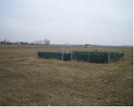 | The Fuchsenbigl CZO is an agricultural research station to study soil productivity and other soil functions in heavily managed arable land. It represents an important economic asset where soil is under threat from intensive agricultural practices. About 0.05 km² agricultural area in the easternmost part of Austria (see map and aerial photo) on sandy-calcaric, loess-like Danube sediments. The soil is a fine sandy-loamy haplic Chernosem. Cultivated crops include winter wheat, barley and sugar beet. It is a research site of the Austrian Agency for Health and Food Safety. The direct distance of the site to the Danube river, from which the sediments derive, is about 8 km. Between the site and the Danube comprehensive research on soil formation was carried out, with the establishment of a chronosequence, from the youngest Danube river sediments to the oldest sediments close to the Fuchsenbigl research site. On the site, 14C-labeled wheat straw and farmyard manure were used in different field experiments, since 1967, which allow to trace soil organic matter turnover processes in the soil very exactly. |
Koiliaris River Basin, Crete, Greece
 | The Koiliaris River watershed is a CZO that represents severely degraded soils due to heavy agricultural impact such as grazing, over many centuries. It represents Mediterranean soils under imminent threat of desertification (soil carbon loss) due to climate change that is predicted for the region over the next century in the UN IPCC predictions. The watershed is located in the eastern part of Chania Prefecture. There are 17 communities in the catchment. The total area is 130 km2. The total length of the river is 36 km. Koiliaris is joined with four tributaries, from which two are temporary rivers (Keramiotis and Anavreti) and two permanent. The springs of Koiliaris River originate from the White Mountains. The climate is Mediterranean and characterized by a separation of seasons. Summer usually is hot/dry and winter is cold/wet. The mean annual rainfall in the northern part of the catchment is 705 mm (447-1032mm). The highest catchment’s slope is 43% at the White Mountains, while gentle slopes (4.8%) are present in the valley and the estuary of Koiliaris. The highest altitude is 2041 m |
Damma Glacier, Canton Uri, Switzerland
 | The site is developed as a CZO within the Swiss Federal Institute of Technology Center of Competence BigLink ( Biosphere-Geosphere interactions: Linking climate change, weathering, soil formation and ecosystem evolution). The CZO represents incipient soil formation during glacial retreat, where bedrock is exposed and glacial outwash deposits new parent material for soil formation at the very eariest stages. The CZO aims at a detailed multidisciplinary study of the initial phase of weathering to obtain a gain a better understanding of the processes occurring at the biosphere-hydrosphere-geosphere interface. We are also developing new geochemical tools to study weathering and soil formation processes. The results will be integrated in a numerical hydrological watershed model. The long-term goal is to improve our understanding of basic processes and improve our ability of up-scaling to larger watersheds and to forecast changes in the hydrology and element fluxes of whole watersheds with changing climate. This alpine site is located in Canton Uri, Switzerland. |
Kladska Lake, Chatteau, Mt. Lysina, Czech Republic
 | The Lysina CZO is an experimental catchment to study the resilience of soil functions to acid deposition and other impacts in heavily managed forest land used for timber production. It represents managed land as an important economic asset where soil is under threat from industrial pollution. Situated in the Protected Area Slavkov Forest, 120 km W from Prague, 10 km N from Marienbad. The main focus is on description of long-term hydrobiogeochemical patterns in the magnesium-poor and acid-sensitive Lysina catchment. Individual tasks: study of element fluxes and pools, wet and dry deposition, internal recycling in trees, soil exchange processes, chemical weathering, nutritional status of trees and toxic metals speciations, modeling predictions of hydrologic, hydrochemical and soil chemical status. Research at Lysina started in 1988. Lysina is a member of the Czech network GEOMON and the three following international networks: ICP-Integrated Monitoring, ICP-Waters, ILTER One paired catchment (satellite site in the vicinity) was selected in 1991 as the second end-members of Norway spruce ecosystem sensitivity to acidic atmospheric deposition: acid resistant Pluhuv Bor underlain by ultramafic magnesium-rich serpentine. |