You are here
LUCAS
LUCAS: Land Use and Coverage Area frame Survey
Following a decision of the European Parliament, the European Statistical Office (EUROSTAT) in close cooperation with the Directorate General responsible for Agriculture and the technical support of the JRC, is organising regular, harmonised surveys across all Member States to gather information on land cover and land use. This survey is known as LUCAS (Land Use/Cover Area frame statistical Survey). The name reflects the methodology used to collect the information. Estimates of the area occupied by different land use or land cover types are computed on the basis of observations taken at more than 250,000 sample points throughout the EU rather than mapping the entire area under investigation. By repeating the survey every few years, changes to land use can be identified.
LUCAS 2009/2012
In 2009, the European Commission extended the periodic Land Use/Land Cover Area Frame Survey (LUCAS) to sample and analyse the main properties of topsoil in 23 Member States of the European Union (EU). This topsoil survey represents the first attempt to build a consistent spatial database of the soil cover across the EU based on standard sampling and analytical procedures, with the analysis of all soil samples being carried out in a single laboratory. Approximately 20,000 points were selected out of the main LUCAS grid for the collection of soil samples. A standardised sampling procedure was used to collect around 0.5 kg of topsoil (0-20 cm). The samples were dispatched to a central laboratory for physical and chemical analyses.
Subsequently, Malta and Cyprus provided soil samples even though the main LUCAS survey was not carried out on their territories. Cyprus has adapted the sampling methodology of LUCAS-Topsoil for (the southern part of the island) while Malta adjusted its national sampling grid to correspond to the LUCAS standards. Bulgaria and Romania have been sampled in 2012. However, the analysis is ongoing and the results are not included in this data collection. The final database contains 19,967 geo-referenced samples distributed in 25 countries. The data are freely available and can be downloaded after prior registration through the Request Form..
The report "LUCAS Topsoil Survey: methodology, data and results" provides a detailed insight to the design and methodology of the data collection and laboratory analysis.
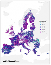
All samples have been analysed for the percentage of coarse fragments, particle size distribution (% clay,silt and sand content), pH (in CaCl2 and H2O), organic carbon (g/kg), carbonate content (g/kg), phosphorous content (mg/kg), total nitrogen content (g/kg), extractable potassium content (mg/kg) , cation exchange capacity (cmol(+)/kg) and multispectral properties.

Fig. 1: LUCAS Soil workflow from sampling to database generation
While the LUCAS approach is designed for monitoring land use/land cover change, potential bias in the sampling design may not necessarily capture all soil characteristics in a country. Finally, a customised application has been developed for web browsers that allow users to view and query the LUCAS dataset in a variety of ways.
LUCAS 2015
The LUCAS 2015 Soil Module targeted a revisit to 90% of the locations sampled in the 2009 survey and expanded to cover all 28 EU Member States (MS) and locations at altitudes above 1000 m. The remaining 10% of samples were reassigned to new locations within each MS. Approximately 22,000 samples have been analysed for pH, organic carbon, nutrient concentrations (N, P, K) and electrical conductivity (new in 2015) - over 23 000 samples were analysed if countries outside the EU). Particle size has was only measured for locations that were sampled for the first time in 2015 (otherwise see 2009 data for particle size).
An additional 1,000 samples (approximately) were collected and analysed from Albania, Bosnia-Herzegovina, Croatia, North Macedonia, Montenegro, Serbia and Switzerland. Data for these countries will be uploaded in the coming months.
The principal products that will be available from this site will be:
- Topsoil data from 2015 are available as CSV files. To facilitate use of the data, .XLS and ESRI shapefile formats are also available
- A report describing the 2015 dataset for the EU and a report describing changes between 2009 and 2015.
- Reference ancillary data describing a range of environmental conditions for the LUCAS Soil locations together with a supporting report
- Topsoil microdata for individual countries
- A report on data evaluation of laboratory data for soil organic carbon (Survey periods 2009, 2012 and 2015)
- Multispectral reflectance data
- X-Ray Diffraction data on a subset of 400 samples
- Data from samples collected during 2015 in Switzerland using the same methodology are available from here.
- Data from Albania, Bosnia and Herzegovina, North Maccedonia, Montenegro, Serbia collected during 2015 using the same methodology.
The data are freely available and can be downloaded after prior registration through the Request Form.
LUCAS 2018
In 2018, the LUCAS Soil survey will include the additional analyses (components 2, 3 and 4) for the first time: a) Bulk density (i.e. weight of dry soil in a given soil volume). b) Soil biodiversity c) Visual assessment of soil erosion and d) Measurement of the thickness of the organic horizon in organic-rich soil.
Soil biodiversity analysis: The most extensive EU assessment of soil biodiversity, based on DNA metabarcoding will be included as part of the LUCAS Soil survey. For this, 1000 points were selected. Analysis will target the following attributes: Bacteria and Archaea (16S rDNA), Fungi (ITS), Eukaryotes (18S rDNA), Microfauna (nematodes), Mesofauna (arthropods), Macrofauna (earthworms), Metagenomics.
Bulk density will be measured at 9000 points. Points were selected from the total set based on the heterogeneity of soil texture and organic carbon content, land use and land cover, topography and soil type. A CLHS approach was used to select candidate points, as for the biodiversity. Bulk density data points coincided with soil biodiversity points to explore possible correlation between these properties.
Visual assessment of erosion.Surveyors will provide a qualitative assessment of soil erosion by indicating the type of erosion (i.e. sheet, rill, gully, mass movement, re-deposition and wind erosion), and the distance and direction from the LUCAS point, together with an estimate of the number of rills or gullies observed.
Measurement of thickness of organic horizon in organic-rich soil. The thickness of the organic horizon in effectively or potentially organic-rich soil will be measured at 1470 locations.
The data are freely available and can be downloaded after prior registration through the Request Form.
LUCAS 2022
The purpose of this document, prepared by JRC and Eurostat, is to:
- explain the underlying principles behind the LUCAS soil module,
- describe its subsequent development driven by the policy needs of the Commission, research, and lately, also by some countries, and
- present a proposal to adapt, adjust and improve the LUCAS Soil methodology for the 2022 Survey so that it serves the evolving policy needs of EC services, and beyond,
- identify mechanisms for increased involvement with Member States.
Use of LUCAS topsoil database
The LUCAS 2009 topsoil database is available for download since September 2013. This database has extensively used for modelling purposes and the development or validation of ten datasets in European scale: Soil Organic carbon content in Europe, Multispectral reflectance data in EU soil, Soil erodibility (K-factor), Soil organic carbon (SOC) stocks, Soil water erosion, Physical properties, Threats to soil biodiversity in EU, wind erosion modelling, N2O emissions in EU and future SOC stocks.
The LUCAS topsoil dataset and the derived products have been downloaded more than 4,500 times from the European Soil Data Centre (ESDAC) during the period (Sep 2013 - Sep 2017). The LUCAS Soil dataset has a wide range of potential applications: a) Modelling of soil-related properties at the continental scale. b) Assessing the contribution of the soil component to regulation c) of large-scale environmental phenomena such as climate change and nutrient cycles. d) Validation of small-scale models involving soil properties e) Comparison and checking of the quality of national and regional soil inventories. f) Assessing the ecosystem services provided by soil g) Evaluation of the effect of soil on key economic activities such
as agriculture.
A post assessment survey of LUCAS data was conducted in order to evaluate the data utility, the scale and te publication outputs. Overall, statistics on LUCAS Soil download and use emphasize the value of such a resource. Continuous development of the LUCAS Soil database and derived datasets will ensure further growth of potentially interested users and thus their application in new fields of research.

Fig. 2: Numbers of downloads of LUCAS 2009–2012 point data (a) per country and (b) per type of organization. Values indicate the number of download(s). (c) A word cloud analysis (Wordle, 2017) of replies regarding data use. The analysis shows the 100 most common words used by the respondents.Word size is proportional to the number of repetitions. (d) Percentages of the LUCAS use potential. In 2015, a post-download questionnaire was sent to all users. Respondents were asked to provide information on three aspects: (i) scale at which data were used, (ii) utility of the data and (iii) publication output associated with LUCAS.
Access to the LUCAS Soil Archive - Soil Memory Bank
At the completion of the laboratory analysis, the residues of the samples from each survey (around 200-300g per point) are stored in the LUCAS Soil Archive, located at the Joint Research Centre in Ispra, Italy. The LUCAS Soil Archive has renamed as Soil Memory Bank (SMB)
They exist in two forms:
- sieved and oven-dried samples
- samples that were frozen very soon after collection (for 2018 and 2022 only)
The European Union Soil Observatory (EUSO) is willing to make part of the samples in the LUCAS archive accessible to those who want to analyse then for further research purposes.
The form available on this webpage is to be used for starting the procedure to obtain access to the LUCAS archive. The EUSO will evaluate the scientific and policy-relevance of the proposal in deciding to grant access.
LUCAS in Eurostat Website
- Land cover/use (LUCAS) Data 2009
- Land cover/use (LUCAS) Data 2012
- Land cover/use (LUCAS) Data 2015
- Land cover/use (LUCAS) Data 2018
- Land cover/use LUCAS) Methodology
Documentation - Publications
The documentation associated to the 2009 LUCAS Soil data is available from the report:
- Tóth, G., Jones, A., Montanarella, L. (eds.) 2013. LUCAS Topsoil Survey. Methodology, data and results. JRC Technical Reports. Luxembourg. Publications Office of the European Union, EUR26102 – Scientific and Technical Research series – ISSN 1831-9424 (online); ISBN 978-92-79-32542-7; doi: 10.2788/97922"
The documentation/reports associated to the 2015 LUCAS Soil data is available from the following reports:
report describing the 2015 dataset for the EU:
Jones, A, Fernandez-Ugalde, O., Scarpa, S. LUCAS 2015 Topsoil Survey. Presentation of dataset and results, EUR 30332 EN, Publications Office of the European Union: Luxembourg. 2020, ISBN 978-92-76-21080-1, doi:10.2760/616084, JRC121325
report describing changes between 2009 and 2015.
Fernández-Ugalde, O., Ballabio, C., Lugato, E., Scarpa, S., Jones, A., Assessment of changes in topsoil properties in LUCAS samples between 2009/2012 and 2015 surveys, EUR 30147 EN, Publications Office of the European Union: Luxembourg 2020, ISBN 978-92-76-17430-1, doi:10.2760/5503, JRC120138.
The following report may provide further insights to the data. It is an evaluation of results from LUCAS Soil Component survey of 2009, 2012 and 2015 for consistency and comparability of repeated and new samples of the soil organic carbon analytical parameter.The reader should be warned that this report refers to a different number of total points than the released data, and also makes explicit reference to data that are stored internally to ESDAC, but are not available to the public:
R. Hiederer, Data Evaluation of LUCAS Soil Survey Laboratory 2009 to 2015 Data, EUR 30092 EN, Publications Office of the European Union, Luxembourg, 2020, ISBN, 978-92-76-15648-2, doi:10.2760/791714, JRC119881.
The following Science-policy report provides insights on how the two indicators (Soil erosion, Soil organic carbon) have been developed using the LUCAS topsoil data of 2009 and 2015:
Panagos, P., Ballabio, C., Scarpa, S., Borrelli, P., Lugato, E. and Montanarella, L., Soil related indicators to support agro-environmental policies, EUR 30090 EN, Publications Office of the European Union, Luxembourg, 2020, ISBN 978-92-76-15644-4, doi:10.2760/011194
The documentation/reports associated to the 2018 LUCAS Soil data is available from the following report:
- Fernandez-Ugalde, O; Scarpa, S; Orgiazzi, A.; Panagos, P.; Van Liedekerke, M; Marechal A. & Jones, A. LUCAS 2018 Soil Module. Presentation of dataset and results, EUR 31144 EN, Publications Office of the European Union, Luxembourg. 2022, ISBN 978-92-76-54832-4, doi:10.2760/215013, JRC129926
Peer-reviewed publications relevant to the 2009 data:
- Orgiazzi, A., Ballabio, C., Panagos, P., Jones, A., Fernández-Ugalde, O. 2018. LUCAS Soil, the largest expandable soil dataset for Europe: A review. European Journal of Soil Science, 69(1): 140-153, DOI: 10.1111/ejss.12499
- Orgiazzi, A., Panagos, P., Fernández‐Ugalde, O., Wojda, P., Labouyrie, M., Ballabio, C., Franco, A., Pistocchi, A., Montanarella, L. and Jones, A., 2022. LUCAS soil biodiversity and LUCAS soil pesticides, new tools for research and policy development. European Journal of Soil Science, 73(5), p.e13299.
- Ballabio, C., Lugato, E., Fernández-Ugalde, O., Orgiazzi, A., Jones, A., Borrelli, P., Montanarella, L. and Panagos, P., 2019. Mapping LUCAS topsoil chemical properties at European scale using Gaussian process regression. Geoderma, 355, p.113912.
- Ballabio, C., Panagos, P. and Montanarella, L., 2016. Mapping topsoil physical properties at European scale using the LUCAS database. Geoderma, 261: 110-123.
- Ballabio, C., Jones, A. and Panagos, P., 2024. Cadmium in topsoils of the European Union–an analysis based on LUCAS topsoil database. Science of the Total Environment, 912, p.168710.
- Ballabio, C., Panagos, P., Lugato, E., Huang, J.H., Orgiazzi, A., Jones, A., Fernández-Ugalde, O., Borrelli, P. and Montanarella, L., 2018. Copper distribution in European topsoils: An assessment based on LUCAS soil survey. Science of the Total Environment, 636:.282-298.
- Ballabio, C., Jiskra, M., Osterwalder, S., Borrelli, P., Montanarella, L. and Panagos, P., 2021. A spatial assessment of mercury content in the European Union topsoil. Science of the Total Environment, 769, p.144755.
- Fendrich, A.N., Van Eynde, E., Stasinopoulos, D.M., Rigby, R.A., Mezquita, F.Y. and Panagos, P., 2024. Modeling arsenic in European topsoils with a coupled semiparametric (GAMLSS-RF) model for censored data. Environment International, 185, p.108544.
- Van Eynde, E., Fendrich, A.N., Ballabio, C. and Panagos, P., 2023. Spatial assessment of topsoil zinc concentrations in Europe. Science of the Total Environment, 892, p.164512.
- Toth G., Jones A., Montanarella L. (2013) The LUCAS topsoil database and derived information on the regional variability of cropland topsoil properties in the European Union. Environmental Monitoring and Assessment, 185 (9), pp. 7409-7425.
- de Brogniez D., Ballabio C., Stevens A., Jones R.J.A., Montanarella L., van Wesemael B. 2015. A map of the topsoil organic carbon content of Europe generated by a generalized additive model. European Journal of Soil Science, 66 (1) , pp. 121-134.
- Panagos, P., Meusburger, K., Ballabio, C., Borrelli, P. and Alewell, C., 2014. Soil erodibility in Europe: A high-resolution dataset based on LUCAS. Science of the total environment, 479, pp.189-200.
- Panagos P., Ballabio, C., Yigini, Y., Dunbar M. (2013) Estimating the soil organic carbon content for European NUTS2 regions based on LUCAS data collection Science of The Total Environment Volume 442, pp. 235–246.
- Panagos, P., Meusburger, K., Ballabio, C., Borrelli, P., Alewell, C. (2014) Soil erodibility in Europe: A high-resolution dataset based on LUCAS. Science of Total Environment, 479–480 (2014) pp. 189–200
- Stevens, A., Nocita, M., Toth, G., Montanarella, L., Van Wesemael, B. (2013) Prediction of Soil Organic Carbon at the European Scale by Visible and Near InfraRed Reflectance Spectroscopy. PLoS ONE, 6.
- Nocita, M, Stevens, A.. Toth, G., Panagos, P., van Wesemael, B., Montanarella, L. 2013. Prediction of soil organic carbon content by diffuse reflectance spectroscopy using a local partial least square regression approach. Soil Biology and Biochemistry. 68 , pp. 337-347, DOI: 10.1016/j.soilbio.2013.10.022
Peer-reviewed publications relevant to the 2015 data:
- Scientific publication describing the LUCAS survey as a whole.
Orgiazzi, A., Ballabio, C., Panagos, P., Jones, A., Fernández-Ugalde, O. 2018. LUCAS Soil, the largest expandable soil dataset for Europe: A review. European Journal of Soil Science, 69(1): 140-153, DOI: 10.1111/ejss.12499
- Comparison of sampling with the Swiss sampling method.
Fernández‐Ugalde, O, Jones, A, Meuli, RG. Comparison of sampling with a spade and gouge auger for topsoil monitoring at the continental scale. Eur J Soil Sci. 2020; 71: 137– 150. https://doi.org/10.1111/ejss.12862
Find below the distribution of 18,984 points in LUCAS 2018 and the distribution of 21,859 point in LUCAS 2015:
| NUTS_ID | CNTR_CODE | NAME_LATN | NUTS_NAME | NUMPOINTS |
| AT | AT | Österreich | Österreich | 451 |
| BE | BE | Belgique/Belgi | Belgique/Belgi | 130 |
| BG | BG | Bulgaria | България | 573 |
| CY | CY | Kýpros | Κύπρος | 69 |
| CZ | CZ | Česko | Česko | 445 |
| DE | DE | Deutschland | Deutschland | 778 |
| DK | DK | Danmark | Danmark | 171 |
| EE | EE | Eesti | Eesti | 200 |
| EL | EL | Elláda | Ελλάδα | 599 |
| ES | ES | España | España | 3866 |
| FI | FI | Suomi/Finland | Suomi/Finland | 1145 |
| FR | FR | France | France | 2735 |
| HR | HR | Hrvatska | Hrvatska | 104 |
| HU | HU | Magyarország | Magyarország | 354 |
| IE | IE | Éire/Ireland | Éire/Ireland | 143 |
| IT | IT | Italia | Italia | 1241 |
| LT | LT | Lietuva | Lietuva | 384 |
| LU | LU | Luxembourg | Luxembourg | 35 |
| LV | LV | Latvija | Latvija | 334 |
| MT | MT | Malta | Malta | 2 |
| NL | NL | Nederland | Nederland | 99 |
| PL | PL | Polska | Polska | 1376 |
| PT | PT | Portugal | Portugal | 430 |
| RO | RO | România | România | 603 |
| SE | SE | Sverige | Sverige | 1904 |
| SI | SI | Slovenija | Slovenija | 113 |
| SK | SK | Slovensko | Slovensko | 187 |
| UK | UK | United Kingdo | United Kingdo | 513 |
Find below the distribution of 19.967 points in LUCAS 2009/12 and the distribution of 21,859 point in LUCAS 2015:
| Country | LUCAS 2009/12 | LUCAS 2015 |
|---|---|---|
| AT | 420 | 543 |
| BE | 71 | 146 |
| BG | 661 | 536 |
| CY | 90 | 76 |
| CZ | 431 | 440 |
| DE | 1947 | 1687 |
| DK | 232 | 222 |
| EE | 220 | 194 |
| ES | 2696 | 4027 |
| FI | 1716 | 1149 |
| FR | 2952 | 3050 |
| GR | 491 | 643 |
| HU | 497 | 412 |
| IE | 233 | 197 |
| IT | 1333 | 1642 |
| LT | 356 | 352 |
| LU | 3 | 13 |
| LV | 349 | 310 |
| MT | 3 | |
| NL | 211 | 172 |
| PL | 1648 | 1377 |
| PT | 476 | 447 |
| RO | 1373 | 1085 |
| SE | 2696 | 1903 |
| SI | 112 | 147 |
| SK | 268 | 228 |
| UK | 942 | 744 |
|
|
Title: LUCAS Topsoil data for the Western Balkans | |
|
Resource Type: Datasets, Soil Point Data Theme/Sub-Theme: Soil Sampling Registration requested: Request Form |
Continent: Year: 2026 Keywords: soil point data, Soil sampling, Western Balkans |
|
|
|
||
 |
Title: LUCAS Heavy Metals | |
|
Resource Type: Datasets, Soil Threats Data Theme/Sub-Theme: Soil Contamination Registration requested: Request Form |
Continent: Year: 2026 Keywords: pollution |
|
|
|
||
 |
Title: LUCAS 2022 TOPSOIL data | |
|
Resource Type: Datasets, Soil Point Data Theme/Sub-Theme: Soil Organic Carbon Content, Soil Nutrients, Soil pH, Soil Sampling |
Continent: Year: 2025 Publisher: European Commission Keywords: LUCAS, LUCAS SOIL, clay, silt, sand, coarse fragments, pH, OC, SOC, Organic Carbon Content, carbonates, CaCO3, nitrogen, phosphorous, potassium, N, P, K, EC, Electrical conductivity, Oxalate extractable Fe, Oxalate extractable Al |
|
|
Attachments:
|
||
 |
Title: LUCAS 2018 TOPSOIL data | |
|
Resource Type: Datasets, Soil Point Data Theme/Sub-Theme: Soil Organic Carbon Content, Soil Nutrients, Soil pH, Soil Sampling Registration requested: Request Form |
Continent: Year: 2022 Publisher: European Commission Keywords: LUCAS, LUCAS SOIL, clay, silt, sand, coarse fragments, pH, OC, SOC, Organic Carbon Content, carbonates, CaCO3, nitrogen, phosphorous, potassium, N, P, K, EC, Electrical conductivity, Oxalate extractable Fe, Oxalate extractable Al |
|
|
Attachments:
|
||
 |
Title: LUCAS 2015 TOPSOIL data | |
|
Resource Type: Datasets, Soil Point Data Theme/Sub-Theme: Soil Sampling Registration requested: Request Form |
Continent: Year: 2020 Keywords: soil point data, Soil sampling, EU |
|
|
Attachments:
|
||
 |
Title: LUCAS 2015 Topsoil data of Switzerland | |
|
Resource Type: Datasets, Soil Point Data Registration requested: Request Form |
Continent: Author: Oihane Fernandez Ugalde, Arwyn Jones, R.G. Meuli Year: 2019 Publisher: European Commission - Joint Research Centre Keywords: LUCAS, 2015, Topsoil, spade method, gouge auger method, swizerland |
|
 |
Title: Copper distribution in topsoils in the European Union | |
|
Resource Type: Datasets, Soil Threats Data Theme/Sub-Theme: Soil Contamination Registration requested: Request Form |
Continent: Year: 2018 Publisher: Joint Research Centre of the European Commission Keywords: Copper| soil contamination | Cu | Vineyards |
|
|
Attachments:
|
||
 |
Title: SPADE/M | |
|
Resource Type: Datasets, Soil Point Data |
Continent: Year: 2004 |
|
|
|
||
 |
Title: LUCAS 2009 TOPSOIL data | |
|
Resource Type: Datasets, Soil Point Data Theme/Sub-Theme: Soil Sampling Registration requested: Request Form |
Continent: Year: 2013 |
|
|
|
||