
You are here
National Soil Maps (EUDASM)
For some 40 years, ISRIC – World Soil Information has been providing significant support to the international science community by collecting and archiving regional-, national- and global-scale maps of soils and land resources. Despite effective procedures for storage and maintenance, most organizations involved in archiving struggle to arrest the deterioration of paper maps and the quality of information they contain. Deterioration occurs for various reasons that include handling, transport, exposure to light, moisture and atmospheric pollution. Realizing the need to conserve the information on existing maps, which underpin the fast-developing thematic mapping strategies to support soil protection, the Joint Research Centre (JRC) of the European Commission (Italy) and ISRIC – World Soil Information initiated the European Digital Archive of Soil Maps (EuDASM). The objective is to transfer soil information into digital format, with the maximum resolution possible and to preserve the information of paper maps that are vulnerable to deterioration.
You are adviced to select the "Country" or the "Continent" (Filter) to which you are interested in and then browse the maps.
More Information about EuDASM (Proposed citation):
Panagos, P., Jones, A., Bosco, C., Senthil Kumar P.S. European digital archive on soil maps (EuDASM): preserving important soil data for public free access. International Journal of Digital Earth (2011), 4 (5), pp. 434-443. DOI:10.1080/17538947.2011.596580
All Resources

|
Kelowna British Columbia |
|
|
Resource Type: National Soil Maps (EUDASM), Maps, Maps & Documents |
Continent: North America Country:  Canada Canada Author: Surveys and Mapping Branch Year: 1968 Publisher: Surveys and Mapping Branch Language: En & Fr Keywords: Kelowna |
|
|
|
||
|
Melville Peninsula-Southampton Island Study Area Costal Classification |
|
|
Resource Type: National Soil Maps (EUDASM), Maps, Maps & Documents |
Continent: North America Country:  Canada Canada Author: Brown R.J.E. et al Year: 1984 Publisher: Surveys and Mapping Branch Language: En |
|
|
|
||

|
Reindeer Station District Of Mackenzie Northwest Territories |
|
|
Resource Type: National Soil Maps (EUDASM), Maps, Maps & Documents |
Continent: North America Country:  Canada Canada Author: Surveys and Mapping Branch Year: 1966 Publisher: Surveys and Mapping Branch Language: En & Fr Keywords: Reindeer Station |
|
|
|
||

|
Conventional Signs |
|
|
Resource Type: National Soil Maps (EUDASM), Maps, Maps & Documents |
Continent: North America Country:  Canada Canada Author: Surveys and Mapping Branch Year: 1976 Publisher: Surveys and Mapping Branch Language: En & Fr |
|
|
|
||

|
Wetlands Of Canada (sheet no.2) |
|
|
Resource Type: National Soil Maps (EUDASM), Maps, Maps & Documents |
Continent: North America Country:  Canada Canada Author: G. D. Adams et al Year: 1981 Publisher: - Language: En & Fr |
|
|
|
||

|
Repulse Bay |
|
|
Resource Type: National Soil Maps (EUDASM), Maps, Maps & Documents |
Continent: North America Country:  Canada Canada Author: Brown R.J.E. et al Year: 1984 Publisher: Surveys and Mapping Branch Language: En |
|
|
|
||
|
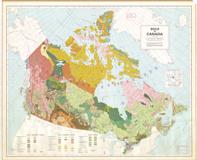
Soils Of Canada |
|
|
Resource Type: National Soil Maps (EUDASM), Maps, Maps & Documents |
Continent: North America Country:  Canada Canada Author: Cartographic Sections of the Soil Research Institute Year: 1972 Publisher: Cartographic Sections of the Soil Research Institute Language: En |
|
|
|
||

|
Forest Regions Of Canada |
|
|
Resource Type: National Soil Maps (EUDASM), Maps, Maps & Documents |
Continent: North America Country:  Canada Canada Author: Graphic Services & Forestery Branch Year: 1972 Publisher: - Language: En |
|
|
|
||

|
Reatreat Of Wisconsin And Recent Ice In North America (sheet no.1) |
|
|
Resource Type: National Soil Maps (EUDASM), Maps, Maps & Documents |
Continent: North America Country:  Canada Canada Author: Geological Survey Of Canada Year: 1969 Publisher: Geological Survey Of Canada Language: En |
|
|
|
||
|
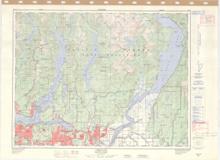
Coquitlam New Westminster Land District British Columbia |
|
|
Resource Type: National Soil Maps (EUDASM), Maps, Maps & Documents |
Continent: North America Country:  Canada Canada Author: Surveys and Mapping Branch Year: 1976 Publisher: Surveys and Mapping Branch Language: En & Fr Keywords: Coquitlam |
|
|
|
||

|
Wetlands Of Canada (sheet no.1) |
|
|
Resource Type: National Soil Maps (EUDASM), Maps, Maps & Documents |
Continent: North America Country:  Canada Canada Author: G. D. Adams et al Year: 1981 Publisher: - Language: En & Fr |
|
|
|
||
|
Reatreat Of Wisconsin And Recent Ice In North America (sheet no.2) |
|
|
Resource Type: National Soil Maps (EUDASM), Maps, Maps & Documents |
Continent: North America Country:  Canada Canada Author: Geological Survey Of Canada Year: 1969 Publisher: Geological Survey Of Canada Language: En |
|
|
|
||

|
Official Map Of Canada (sheet no. 1) |
|
|
Resource Type: National Soil Maps (EUDASM), Maps, Maps & Documents |
Continent: North America Country:  Canada Canada Author: Geological Survey Of Canada Year: 1968 Publisher: Geological Survey Of Canada Language: En |
|
|
|
||

|
Official Map Of Canada (sheet no. 2) |
|
|
Resource Type: National Soil Maps (EUDASM), Maps, Maps & Documents |
Continent: North America Country:  Canada Canada Author: Geological Survey Of Canada Year: 1968 Publisher: Geological Survey Of Canada Language: En |
|
|
|
||

|
Tectonic Map Of Canada (sheet no.1) |
|
|
Resource Type: National Soil Maps (EUDASM), Maps, Maps & Documents |
Continent: North America Country:  Canada Canada Author: Geological Survey Of Canada Year: 1969 Publisher: Geological Survey Of Canada Language: En |
|
|
|
||

|
Tectonic Map Of Canada (sheet no.2) |
|
|
Resource Type: National Soil Maps (EUDASM), Maps, Maps & Documents |
Continent: North America Country:  Canada Canada Author: Geological Survey Of Canada Year: 1969 Publisher: Geological Survey Of Canada Language: En |
|
|
|
||

|
Geological Map Of Canada (sheet no.1) |
|
|
Resource Type: National Soil Maps (EUDASM), Maps, Maps & Documents |
Continent: North America Country:  Canada Canada Author: Geological Survey Of Canada Year: 1969 Publisher: Geological Survey Of Canada Language: En |
|
|
|
||

|
Geological Map Of Canada (sheet no.2) |
|
|
Resource Type: National Soil Maps (EUDASM), Maps, Maps & Documents |
Continent: North America Country:  Canada Canada Author: Geological Survey Of Canada Year: 1969 Publisher: Geological Survey Of Canada Language: En |
|
|
|
||
|
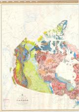
Geological Map Of Canada (sheet no.1) |
|
|
Resource Type: National Soil Maps (EUDASM), Maps, Maps & Documents |
Continent: North America Country:  Canada Canada Author: Geological Survey Of Canada Year: 1969 Publisher: Geological Survey Of Canada Language: En |
|
|
|
||

|
Geological Map Of Canada (sheet no.2) |
|
|
Resource Type: National Soil Maps (EUDASM), Maps, Maps & Documents |
Continent: North America Country:  Canada Canada Author: Geological Survey Of Canada Year: 1969 Publisher: Geological Survey Of Canada Language: En |
|
|
|
||
|
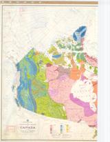
Physiographic Regions Of Canada (sheet no.1) |
|
|
Resource Type: National Soil Maps (EUDASM), Maps, Maps & Documents |
Continent: North America Country:  Canada Canada Author: Geological Survey Of Canada Year: 1970 Publisher: Geological Survey Of Canada Language: En |
|
|
|
||

|
Physiographic Regions Of Canada (sheet no.2) |
|
|
Resource Type: National Soil Maps (EUDASM), Maps, Maps & Documents |
Continent: North America Country:  Canada Canada Author: Geological Survey Of Canada Year: 1970 Publisher: Geological Survey Of Canada Language: En |
|
|
|
||

|
Canada-Relief |
|
|
Resource Type: National Soil Maps (EUDASM), Maps, Maps & Documents |
Continent: North America Country:  Canada Canada Author: Surveys and Mapping Branch Year: 1976 Publisher: - Language: En |
|
|
|
||

|
Soil Climates Of Canada |
|
|
Resource Type: National Soil Maps (EUDASM), Maps, Maps & Documents |
Continent: North America Country:  Canada Canada Author: Cartographic Sections of the Soil Research Institute Year: 1975 Publisher: Cartographic Sections of the Soil Research Institute Language: En |
|
|
|
||
|
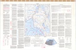
Hurd Channel Northwest Territories |
|
|
Resource Type: National Soil Maps (EUDASM), Maps, Maps & Documents |
Continent: North America Country:  Canada Canada Author: Brown R.J.E. et al Year: 1984 Publisher: Surveys and Mapping Branch Language: En Keywords: Hurd Channel |
|
|
|
||
Go Back To
Filters
Country Maps by Continent
| continent | Available Maps by Continent |
|---|---|
| Africa | 1759 |
| Europe | 1026 |
| North America | 284 |
| South America | 870 |
| Asia | 709 |
Continent Coverage Maps
| continent | Available Coverage Maps |
|---|---|
| Africa | 307 |
| Asia | 247 |
| Europe | 71 |
| South America | 203 |
All Resources
-
Soil Atlas of Asia - 2023Region: AsiaDescription: Asia has fertile land but fragile soils, often lacking essential nutrients and organic matter. Aridity and desertification affect much of the continent, and tropical rainforest soils depend on organic matter from natural vegetation. Deforestation disrupts this cycle and reduces soil productivity,...Language: ENSoil Atlas of Latin America - 2014Region: Latin AmericaDescription: More than half of the 576 million hectares of arable land in Latin America are affected by degradation, particularly in South America and Mesoamerica. The main causes are change in land use, over-exploitation, climate change, and social inequality. The atlas presents strategies for soil...Language: ENKeywords: Atlas, Maps, Soil, Degradation, Sustainability, Biodiversity, Conservation, Latin America, CaribbeanRegion: EuropeDescription: The visually stunning 128-page atlas uses photos, texts, and maps to showcase the diversity of soils across Europe. It serves as a comprehensive guide to soil biology, providing information for non-specialists. The first part covers the below ground environment, soil biota, ecosystem functions, and...Language: ENSoil Atlas of Africa - 2014Region: AfricaDescription: Africa has a diverse range of soil types, with over 60% representing hot, arid, or immature soil assemblages. A further 20% are tropical or subtropical soils. The continent also has a considerable number of soil types associated with local soil-forming factors. Unlike other continents, Africa does...Language: EN, Fr, EPUB & KindleRegion: Northern CircumpolarDescription: The atlas is a result of a three-year collaborative project with partners from northern EU countries, Norway, Iceland, Greenland, Canada, the USA, and Russia. It provides a detailed overview of circumpolar soil resources relevant to agriculture, forest management, water management, land use...Language: ENSoil Atlas of Europe - 2005Region: EuropeDescription: The Soil Bureau Network (ESBN) has contributed to consolidating soil information from various European countries with different methodologies and scientific backgrounds into a single geographic information system (GIS), demonstrating that a harmonized approach is possible. This effort has resulted...Language: ENRegion: GlobalDescription: The Atlas describes soil as habitat for the diversity of organisms that live under our feet. At the same time, it draws attention to the threats to soil biodiversity, such as invasive species, pollution, intensive land use practices or climate change. The Atlas provides current solutions for a...Language: EN
![[title_1]](https://esdac.jrc.ec.europa.eu/public_path//datainventoryitem_img/Asia%20Atlas.jpg)
![[title_1]](https://esdac.jrc.ec.europa.eu/public_path//datainventoryitem_img/Atlas_Latin%20America_thumbnail.jpg)
![[title_1]](https://esdac.jrc.ec.europa.eu/public_path//datainventoryitem_img/Atlas_European%20Soil%20Biodiversity_thumbnail.jpg)
![[title_1]](https://esdac.jrc.ec.europa.eu/public_path//datainventoryitem_img/Atlas_Africa_thumbnail.jpg)
![[title_1]](https://esdac.jrc.ec.europa.eu/public_path//datainventoryitem_img/Atlas_Northern%20circumpolar_thumbnail.jpg)
![[title_1]](https://esdac.jrc.ec.europa.eu/public_path//datainventoryitem_img/Atlas_Europe_thumbnail.jpg)
![[title_1]](https://esdac.jrc.ec.europa.eu/public_path//datainventoryitem_img/Atlas_Biodiversity_thumbnail.jpg)