JOINT RESEARCH CENTRE
European Soil Data Centre (ESDAC)
Land use
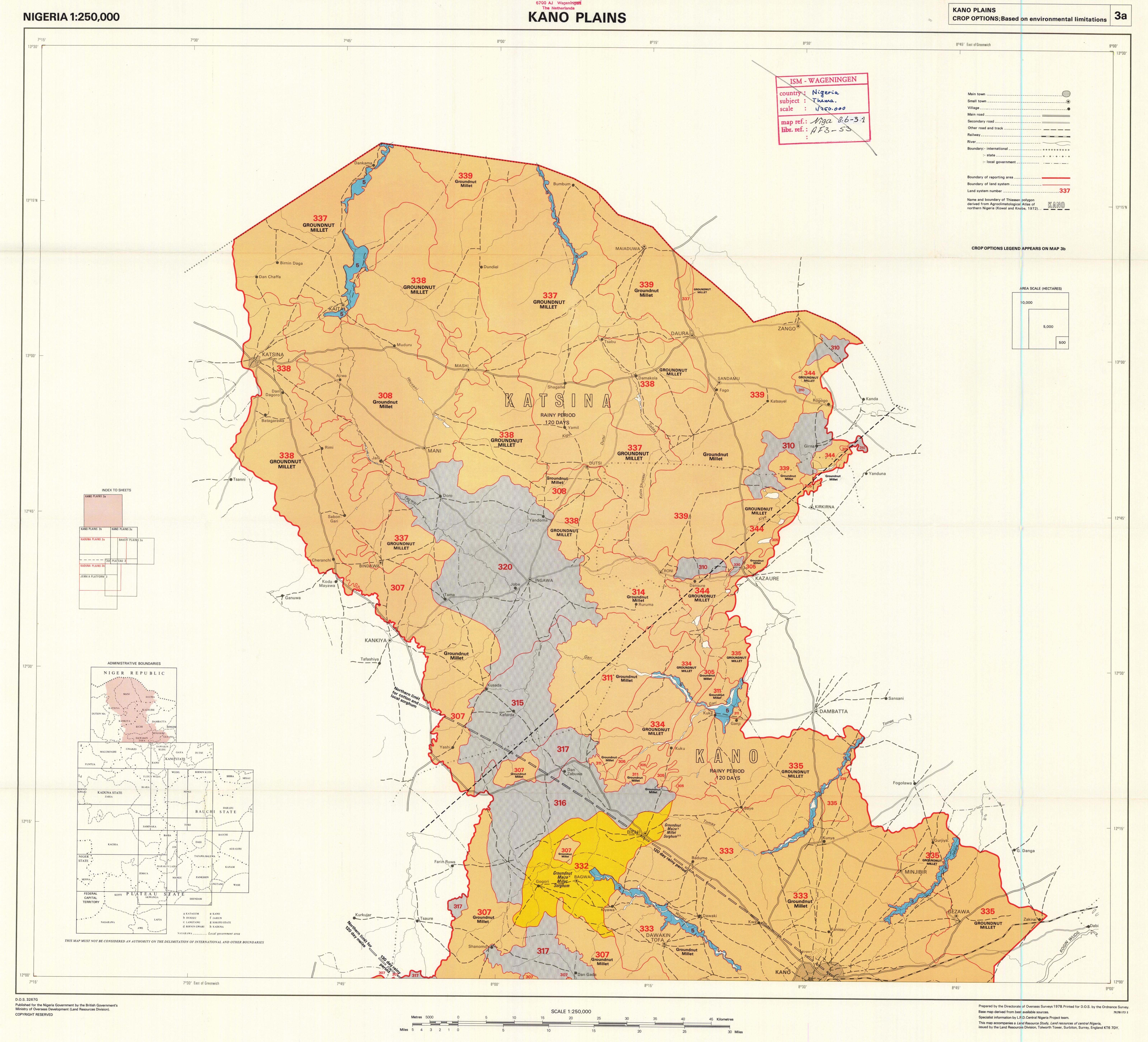 |
Title: Kano Plains. Nigeria. Crop Options, Based on Environmental Limitations. Map 3a. D.O.S. 3267G. | |
|
Resource Type: National Soil Maps (EUDASM), Maps, Maps & Documents |
Continent: Africa Country: Nigeria Year: 1978 Publisher: Nigeria Government by the British Government's Ministry of Overseas Development (Land Resources Division). Language: En Keywords: Land use |
|
|
|
||
 |
Title: Landsat-Based Map of Southwestern Mauritanie (1 of 5). [Carte Basée sur Interprétation Satellite du Sud-Ouest de la Mauritanie (1 déntre 5]. | |
|
Resource Type: National Soil Maps (EUDASM), Maps, Maps & Documents |
Continent: Africa Country: Mauritania Author: Dalsted, K. Year: 1982 Publisher: Government of the Islamic Republic of Mauritania, the United States Agency for International Development and the Remote Sensing Institute South Dakota State University. Keywords: Land use |
|
|
|
||
 |
Title: North East Nigeria. Present Land Use. Map 7. | |
|
Resource Type: National Soil Maps (EUDASM), Maps, Maps & Documents |
Continent: Africa Country: Nigeria Year: 1971 Publisher: The Nigeria Government by the British Government's Ministry of Overseas Development (D.O.S.), under the Special Commonwealth African Assistance Plan. Language: En Keywords: Land use |
|
|
|
||
 |
Title: Jema'a Platform. Nigeria. Present Land Use. Map 2. D.O.S. 3245B. | |
|
Resource Type: National Soil Maps (EUDASM), Maps, Maps & Documents |
Continent: Africa Country: Nigeria Year: 1977 Publisher: Nigeria Government by the British Government's Ministry of Overseas Development (Land Resources Division). Language: En Keywords: Land use |
|
|
|
||
 |
Title: Jos Plateau. Nigeria. Land Systems. Map 1. D.O.S. 3244A. | |
|
Resource Type: National Soil Maps (EUDASM), Maps, Maps & Documents |
Continent: Africa Country: Nigeria Year: 1977 Publisher: Nigeria Government by the British Government's Ministry of Overseas Development (Land Resources Division). Language: En Keywords: Land use |
|
|
|
||
 |
Title: Kano Plains. Nigeria. Present Land Use. Map 2a. D.O.S. 3267D. | |
|
Resource Type: National Soil Maps (EUDASM), Maps, Maps & Documents |
Continent: Africa Country: Nigeria Year: 1978 Publisher: Nigeria Government by the British Government's Ministry of Overseas Development (Land Resources Division). Language: En Keywords: Land use |
|
|
|
||
 |
Title: Benue Valley. Nigeria. Present Land Use. Map 2e. D.O.S. 3232K. | |
|
Resource Type: National Soil Maps (EUDASM), Maps, Maps & Documents |
Continent: Africa Country: Nigeria Year: 1977 Publisher: Nigeria Government by the British Government's Ministry of Overseas Development (Land Resources Division). Language: En Keywords: Land use |
|
|
|
||
 |
Title: Kaduna Plains. Nigeria. Present Land Use. Map 2b. D.O.S. 3261D. | |
|
Resource Type: National Soil Maps (EUDASM), Maps, Maps & Documents |
Continent: Africa Country: Nigeria Year: 1978 Publisher: Nigeria Government by the British Government's Ministry of Overseas Development (Land Resources Division). Language: En Keywords: Land use |
|
|
|
||
 |
Title: North East Nigeria. Land Systems. Map 6b. D.O.S. (LR) 3040B. | |
|
Resource Type: National Soil Maps (EUDASM), Maps, Maps & Documents |
Continent: Africa Country: Nigeria Author: Bawden, M.G., Caroll, D.M., Tuley, P. Year: 1970 Publisher: The Nigeria Government by the British Government's Ministry of Overseas Development (D.O.S.), under the Special Commonwealth African Assistance Plan. Language: En Keywords: Land use |
|
|
|
||
 |
Title: Jema'a Platform. Nigeria. Land systems map. Map 1. D.O.S. 3245A. | |
|
Resource Type: National Soil Maps (EUDASM), Maps, Maps & Documents |
Continent: Africa Country: Nigeria Year: 1976 Publisher: Nigeria Government by the British Government's Ministry of Overseas Development (Land Resources Division). Language: En Keywords: Land use |
|
|
|
||
 |
Title: Land Use and Land Cover in the Central Sokoto-Rima Basin. Northwest Nigeria. | |
|
Resource Type: National Soil Maps (EUDASM), Maps, Maps & Documents |
Continent: Africa Country: Nigeria Year: 1988 Language: En Keywords: Land use |
|
|
|
||
 |
Title: Jos Plateau. Nigeria. Crop Options, Based on Environmental Limitations. Map 3. D.O.S. 3244C. | |
|
Resource Type: National Soil Maps (EUDASM), Maps, Maps & Documents |
Continent: Africa Country: Nigeria Year: 1977 Publisher: Nigeria Government by the British Government's Ministry of Overseas Development (Land Resources Division). Language: En Keywords: Land use |
|
|
|
||
 |
Title: """Land System Map of Western Kenya. GSGS Misc. """"2246/2"""".""" | |
|
Resource Type: National Soil Maps (EUDASM), Maps, Maps & Documents |
Continent: Africa Country: Kenya Author: Lawrance, C.J., Webster, R., Scott, R.M. Year: 1972 Publisher: Director of Military Survey, Ministry of Defence, England. Language: En Keywords: Land use |
|
|
|
||
 |
Title: Land Use Map of Kenya. | |
|
Resource Type: National Soil Maps (EUDASM), Maps, Maps & Documents |
Continent: Africa Country: Kenya Year: 1983 Publisher: Kenya Rangeland Ecological Monitoring Unit, Ministry of Environment and Natural Resources Language: En Keywords: Land use |
|
|
|
||
 |
Title: Republic of Zambia. Land Use. | |
|
Resource Type: National Soil Maps (EUDASM), Maps, Maps & Documents |
Continent: Africa Country: Zambia Author: Schultz, J. Year: 1972 Publisher: Zambia Government. Language: En Keywords: Land use |
|
|
|
||
 |
Title: Republic of Zambia. Land Use. | |
|
Resource Type: National Soil Maps (EUDASM), Maps, Maps & Documents |
Continent: Africa Country: Zambia Author: Schultz, J. Year: 1972 Publisher: Zambia Government. Language: En Keywords: Land use |
|
|
|
||
 |
Title: Northern Nigeria. Southern Sardauna and Southern Adamawa. Land Systems. D.O.S. (L.R.) 3028A. | |
|
Resource Type: National Soil Maps (EUDASM), Maps, Maps & Documents |
Continent: Africa Country: Nigeria Author: Tuley, P., Bawden, M.G. Year: 1966 Publisher: The Nigeria Government by the British Government's Ministry of Overseas Development (D.O.S.), under the Special Commonwealth African Assistance Plan. Language: En Keywords: Land use |
|
|
|
||
 |
Title: Kaduna Plains. Nigeria. Present Land Use. Map 2a. D.O.S. 3261C. | |
|
Resource Type: National Soil Maps (EUDASM), Maps, Maps & Documents |
Continent: Africa Country: Nigeria Year: 1978 Publisher: Nigeria Government by the British Government's Ministry of Overseas Development (Land Resources Division). Language: En Keywords: Land use |
|
|
|
||
 |
Title: North East Nigeria. Distribution of Major Crops including Yields of Groundnuts and Cotton by Buying Stations . Map | |
|
Resource Type: National Soil Maps (EUDASM), Maps, Maps & Documents |
Continent: Africa Country: Nigeria Author: Lesslie, A. Year: 1971 Publisher: The Nigeria Government by the British Government's Ministry of Overseas Development (D.O.S.), under the Special Commonwealth African Assistance Plan. Language: En Keywords: Land use |
|
|
|
||
 |
Title: North East Nigeria. Land Systems. Map 6a. D.O.S. (LR) 3040A. | |
|
Resource Type: National Soil Maps (EUDASM), Maps, Maps & Documents |
Continent: Africa Country: Nigeria Author: Bawden, M.G., Caroll, D.M., Tuley, P. Year: 1970 Publisher: The Nigeria Government by the British Government's Ministry of Overseas Development (D.O.S.), under the Special Commonwealth African Assistance Plan. Language: En Keywords: Land use |
|
|
|
||
 |
Title: North East Nigeria. Potential Land Use. Map 13. | |
|
Resource Type: National Soil Maps (EUDASM), Maps, Maps & Documents |
Continent: Africa Country: Nigeria Year: 1971 Publisher: The Nigeria Government by the British Government's Ministry of Overseas Development (D.O.S.), under the Special Commonwealth African Assistance Plan. Language: En Keywords: Land use |
|
|
|
||
 |
Title: Based on Environmental Limitations. Map 3. D.O.S. 3245C., Jema'a Platform. Nigeria. Crop Options | |
|
Resource Type: National Soil Maps (EUDASM), Maps, Maps & Documents |
Continent: Africa Country: Nigeria Year: 1977 Publisher: Nigeria Government by the British Government's Ministry of Overseas Development (Land Resources Division). Language: En Keywords: Land use |
|
|
|
||
 |
Title: Kano Plains. Nigeria. Crop Options, Based on Environmental Limitations. Map 3b. D.O.S. 3267H. | |
|
Resource Type: National Soil Maps (EUDASM), Maps, Maps & Documents |
Continent: Africa Country: Nigeria Year: 1978 Publisher: Nigeria Government by the British Government's Ministry of Overseas Development (Land Resources Division). Language: En Keywords: Land use |
|
|
|
||
 |
Title: Kano Plains. Nigeria. Crop Options, Based on Environmental Limitations. Map 3c. D.O.S. 3267J. | |
|
Resource Type: National Soil Maps (EUDASM), Maps, Maps & Documents |
Continent: Africa Country: Nigeria Year: 1978 Publisher: Nigeria Government by the British Government's Ministry of Overseas Development (Land Resources Division). Language: En Keywords: Land use |
|
|
|
||
 |
Title: Kano Plains. Nigeria. Land Systems. Map 1a. D.O.S. 3267A. | |
|
Resource Type: National Soil Maps (EUDASM), Maps, Maps & Documents |
Continent: Africa Country: Nigeria Year: 1978 Publisher: Nigeria Government by the British Government's Ministry of Overseas Development (Land Resources Division). Language: En Keywords: Land use |
|
|
|
||