Documents

Over the years, the JRC has produced many publications. These are found in this section. They have been sub-divided in various categories (see Subcategory buttons below). All more than 680 documents can also be inspected irrespective of the category (see 'All documents' below).

Publications in Journals include more than 490 published papers from the Soil Group in the JRC (EU Soil Observatory). Most of the papers refer to the last 11 years (2013-2024). In many cases the papers document the datasets published in ESDAC.

As example statistics, Since the establishement of the EUSO,  the group published:

  • 52 papers in 2025
  • 47 papers in 2024
  • 46 papers in 2023
  • 40 papers in 2022
  • 27 papers in 2021
  • 23 papers in 2020


Most of them in high impact journals including Nature Communicaitons, Climate Change, Global Change Biology, etc. Almost all the publications are Open Access. As publications, we present articles published in peer-review journals indexed in Scopus or Web of Science.

Filters

Go Back To

All Documents

Displaying 51 - 75 of 679 | Show 25 | 50 | All results per page.
Continental Scale Soil Monitoring: A Proposed Multi-Scale Framing of Soil Quality
Resource Type: Maps & Documents, Documents, Publications in Journals
Year: 2025

Globally, soils are subjected to various management practices and stressors which can lead to degradation. This makes their protection essential for sustaining many functions and services as well as maintaining the overall life support system of Earth. National monitoring programmes are increasingly implemented to evaluate the state and trend of soils, a move which has been advocated by the Mission Soil in Europe. In soil science, frameworks have been established to interpret and communicate soil monitoring results, concentrating on the concept of quality, a term which can be interpreted in many ways. This paper explores the multifaceted meaning of soil quality, addressing its implications for future soil health assessments. It achieves this by focusing on the context of the Mission Soil. Soil health is a holistic concept embracing emergence, complexity and highlighting long-term vitality and resilience. In contrast, soil quality is often viewed through the lens of its capacity to meet specific human needs and functions, typically in a shorter timeframe. The concept of quality is assessed through indicators where the choice of framework significantly influences selection and interpretation. However, selecting appropriate soil indicators across Europe is challenging due to diverse climate, topography, geology and soil types, resulting in varied soil processes. Therefore, establishing clear principles and criteria for soil indicator selection is essential. Our paper identifies four distinct frameworks for soil quality assessment: ‘Fitness for Purpose’, ‘Free from Degradation’, ‘External Benchmarking’ and ‘Value Assessment’, with each possessing a unique role and application. Notably, the ‘Free from Degradation’ framework is emphasised for its alignment with soil protection efforts and its relevance to soil threats. This makes it particularly suitable for pan-European assessments conducted by the European Union Soil Observatory (EUSO).

Towards the development of bias-corrected rainfall erosivity time series for Europe
Resource Type: Maps & Documents, Documents, Publications in Journals
Year: 2025

Rainfall erosivity maps for (near) real-time soil erosion predictions require the integration of (combinations of) reanalysis products and satellite-retrievals of rainfall, and the overcoming of potential bias related to their simplified spatial and temporal scale. Across Europe, we evaluate: 1) the European Meteorological Observations (EMO) dataset to simulate the localised characteristics of rainfall erosivity at the event scale (EI30), and 2) different implementations of quantile delta mapping (QDM) bias correction to improve the prediction skill. Between 1990 and 2014, evaluations were made at several spatial (location-specific, climatic zone and pan-European) and temporal (event, annual and long-term annual average) scales. The uncorrected EMO predictions demonstrated: 1) a slight overprediction of the number of EI30 events, 2) a reduced coefficient of variation in the EI30 (CV EMO = 1.57, CV REDES = 2.5), and 3) a relatively low (R2 = 0.22, n = 139,306) location-specific predictive skill, with higher discrepancies in all cases in Southern Europe. Following QDM, the EI30 predictions significantly better represented the large-sample variability of EI30 per climate region and improved the monthly correspondence. 

Global richness of arbuscular mycorrhizal fungi
Resource Type: Maps & Documents, Documents, Publications in Journals
Year: 2025

Arbuscular mycorrhizal (AM) fungi form mutualistic associations with most land plants and are of pivotal importance for plant growth and nutrition. AM fungi include both the well-known phylum Glomeromycota (G-AMF) and the recently established clade of Endogonomycete fine root endophytes within the phylum Mucoromycota, often viewed as putative AMF (E-AMF). Yet, the global richness of these fungal groups, in particular of E-AMF, is poorly understood. To provide comprehensive global species of G-AMF and E-AMF, we analysed long-read sequencing data of the full-length ITS marker from 4,733 sampling sites across all continents and biomes. Our study provides the first combined estimate of global G-AMF and putative E-AMF richness, far exceeding the numbers and taxa reported so far. 

The Impacts of Erosion on the Carbon Cycle
Resource Type: Maps & Documents, Documents, Publications in Journals
Year: 2025

Physical and chemical erosion associated with water both affect land–atmosphere carbon exchanges. However, previous studies have often addressed these processes separately or used oversimplified mechanisms, leading to ongoing debates and uncertainties about erosion-induced carbon fluxes. We provide an overview of the on-site carbon uptake fluxes induced by physical erosion (0.05–0.29 Pg C yr−1, globally) and chemical erosion (0.26–0.48 Pg C yr−1). Then, we discuss off-site carbon dynamics (during transport, deposition, and burial). Soil organic carbon mineralization during transport is nearly 0.37–1.20 Pg C yr−1 on the globe. We also summarize the overall carbon fluxes into estuaries (0.71–1.06 Pg C yr−1) and identify the sources of different types of carbon within them, most of which are associated with land erosion.

Novel deep learning algorithm in soil erodibility factor predicting at a continental scale
Resource Type: Maps & Documents, Documents, Publications in Journals
Year: 2025

Soil erosion poses significant environmental and economic challenges, adversely affecting soil fertility and global agricultural productivity. We developed a novel model based on the Multi-Head Squeeze-and-Excitation Residual One-Dimensional Convolutional Neural Network (MH-SE-Res1DNet) to predict the soil erodibility factor (K) across Europe, representing the first application of this model for such a purpose worldwide. We conducted a comparative analysis using five benchmark machine learning algorithms, i.e., Random Forest (RF), Artificial Neural Network–Multilayer Perceptron (ANN-MLP), Support Vector Regression (SVR), Alternating Model Tree (AMT), and Pace Regression (PR), to assess the efficacy of our model. The results showed that the MH-SE-Res1DNet deep learning model had an outstanding ability for the K prediction.map

doc

pou


Global patterns of gully occurrence and their sensitivity to environmental changes
Resource Type: Maps & Documents, Documents, Publications in Journals
Year: 2025

Gully formation is a significant driver of soil erosion and land degradation worldwide and often leads to important downstream impacts. Nonetheless, our understanding of the global patterns and the factors controlling this process remains limited. Here, we present the first global assessment of gully density's spatial patterns. Using mapped observations from over 17,000 representative study sites worldwide, we trained random forest models that simulate both the susceptibility to gullying at a 1 km2 resolution and the corresponding gully head density (GHD).map

Bacterial richness enhances the thermostability of soil organic matter via a long-term trade-off between molecular diversity and thermodynamic stability
Resource Type: Maps & Documents, Documents, Publications in Journals
Year: 2025

The persistence of soil organic matter (SOM) is shaped by its molecular features and stability, but the temporal dynamics of these features remain unclear. Here we investigate the molecular diversity (the number of molecules) and molecular thermodynamic stability (the theoretical Gibbs free energy for the half reaction of carbon oxidation) of SOM in soils from long-term (>30 years) paddy and upland experimental fields.

Development of a spatial risk indicator for monitoring residential pesticide exposure in agricultural areas
Resource Type: Maps & Documents, Documents, Publications in Journals
Year: 2025

The global increase in pesticide use has raised concerns about its impact on biodiversity, ecosystems, and human health, in particular of people living near agricultural areas. This study explores the assessment of pesticide exposure and risks to residents at a high spatial granularity using plant protection product data. Our objective was to develop an indicator to monitor pesticide risk levels faced by residents in France by integrating spatial datasets and exposure assessment methodologies. Using spatialized pesticide sales data based on crop authorizations, we mapped potential pesticide loads at the parcel level.

Monitoring Systems of Agricultural Soils Across Europe Regarding the Upcoming European Soil Monitoring Law
Resource Type: Maps & Documents, Documents, Publications in Journals
Year: 2025

In Europe, 60%–70% of soils are considered degraded, underscoring the urgent need for consistent monitoring to prevent further degradation and support evidence-based policies for sustainable soil management. Many countries in Europe have implemented one or more soil monitoring systems (SMSs), often established long before the EU-wide “Land Use/Cover Area frame statistical Survey Soil”, LUCAS Soil program. As a result, their sampling strategies and analytical methodologies vary significantly. The proposed EU Directive on Soil Monitoring and Resilience (Soil Monitoring Law, SML) aims to address these differences by establishing a unified framework for systematic soil health monitoring across the EU. This paper assesses the compatibility of the 25 identified SMSs from countries participating in the EJP SOIL Program with the anticipated requirements of the SML.

Comparison of LUCAS and Italian Sampling Procedures for Harmonising Physicochemical and Biological Soil Health Indicators
Resource Type: Maps & Documents, Documents, Publications in Journals
Year: 2025

Comparability of soil data derived from different sources is crucial to obtain consistent results when evaluating the soil health status. Discrepancies may arise due to various factors, including uncertainties resulting from different sampling methods. In this study, we compared various soil Physicochemical properties (ST)—pH, organic carbon, texture, cation exchange capacity, nutrients, heavy metals—and microbial diversity (BIO) of samples collected following both the LUCAS Soil (performed by the European Commission Joint Research Centre, JRC) and the Italian (performed by two regional agencies) procedures. The aim was to evaluate the effect of applying different soil sampling protocols on ST and BIO data. Soil samples from 58 LUCAS Soil 2022 sampling sites located in northern Italy were collected following both sampling protocols. 

Microbial Bioindicators for Monitoring the Impact of Emerging Contaminants on Soil Health in the European Framework
Resource Type: Maps & Documents, Documents, Publications in Journals
Year: 2025

Antibiotic resistance (AR) is recognized by the World Health Organization as a major threat to human health, and recent studies highlight the role of microplastics (MPs) in its spread. MPs in the environment may act as vectors for antibiotic-resistant bacteria (ARB) and antibiotic resistance genes (ARGs). Bacterial communities on the plastisphere, the surface of MPs, are influenced by plastic properties, allowing ARB to colonize and form biofilms. These biofilms facilitate the transfer of ARGs within microbial communities. This study analyzed data from the LUCAS soil dataset (885 soil samples across EU countries) using the Emu tool to characterize microbial communities at the genus/species level.

From data to fork” data-driven science inspired by policy initiatives for the promotion of smart agricultural technologies
Resource Type: Maps & Documents, Documents, Publications in Journals
Year: 2025

The special issue “From data to Fork” gathered 15 papers from all over the world in cross-cutting areas of Smart Agriculture Research, including new algorithm development for the agricultural sector, food security, and ecosystem well-being and several study cases. We promoted the concept of reviews and original research papers reporting applications of smart farming from field to fork. The editorial proposed some main groups of papers in the following sections: i) Advances in Precision Agriculture and Crop Monitoring; ii) Technological Innovation for Farm Management and Infrastructure; iii) Digital Outreach and Decision Support Systems.

Quantifying the Accuracy, Uncertainty, and Sensitivity of Soil Geochemical Multisurface Models
Resource Type: Maps & Documents, Documents, Publications in Journals
Year: 2025

Geochemical multisurface models and their generic parameters for the solid-solution partitioning and speciation of metals have been used for decades. For soils the collective uncertainty and sensitivity of model parameters and soil-specific reactive surface properties has been insufficiently evaluated. We used statistical tools and data of diverse soils to quantify for Cd, Cu and Zn the uncertainty of model parameters and input values of the nonideal competitive adsorption (NICA)-Donnan model for organic matter (OM) coupled with the generalized two-layer model for metal-oxides. Subsequently, we quantified the uncertainty of speciation predictions and the sensitivity to model parameters and input values. Importantly, we established new generic NICA-Donnan parameters that substantially improved model accuracy, especially for Zn. Uncertainties generally followed Cu < Cd < Zn. With OM being the major binding surface across most soils, the affinity parameters (log Ki) were most influential.

A bottom-up perspective on how fire changes ecosystem biogeochemistry via plant-soil interactions
Resource Type: Maps & Documents, Documents, Publications in Journals
Year: 2025

The effect of fire on plants and soils cannot be viewed in isolation. Plant-soil interactions, and their role in determining the response of ecosystem to fire, has been a widely debated topic. Most studies describe patterns rather than the mechanisms that may lead to variable effects on soils across ecosystems.

Spatially varying parameters improve carbon cycle modeling in the Amazon rainforest with ORCHIDEE r8849map
Resource Type: Maps & Documents, Documents, Publications in Journals
Year: 2025

 Here we assess the importance of spatially varying parameters to resolve ecosystem spatial heterogeneity in the ORCHIDEE (ORganizing Carbon and Hydrology in Dynamic EcosystEms) DGVM. Using satellite observations of tree aboveground biomass (AGB), gross primary productivity (GPP), and biomass mortality rates, we optimized two key parameters: the alpha self-thinning (α), which controls tree mortality induced by light competition, and the nitrogen use efficiency of photosynthesis (η), which regulates GPP. 

Soil heating during wildfires and prescribed burns: a global evaluation
Resource Type: Maps & Documents, Documents, Publications in Journals
Year: 2025

Fires can alter soil properties via downward heat transfer. Numerous studies have examined effects of wildfires and prescribed burns on soils, yet knowledge of the soil temperatures and durations reached is limited. This can lead to erroneous assumptions regarding fire impacts, especially when laboratory heating results are extrapolated to field conditions.

World Soil Day 2025
World Soil Day 2025
Resource Type: Maps & Documents, Documents, Poster Publications
Year: 2025
World soil day posters created to celebrate the annual milestone. Two posters were created, the first one uses the visual metaphor of a human silhouette symbolising the link between soil health, human well-being and strategic autonomy.
The second option with the hands, conveys a tactile human connection to soil, with a change in the subhead which aims to set an action-oriented tone. 
 
The posters are answering the following questions:
Why it matters?
How we act?
Impact?
 
To this we have also added quantitative anchors with the figures  (e.g., €10 billion annual cost, 60–70% soil degradation) adding to the urgency around the current state of soils.
Digging up soil facts
Resource Type: Maps & Documents, Documents, Poster Publications
Year: 2025

Poster with six key facts reveal Europe's soil crisis—erosion, contamination, sealing, biodiversity loss, carbon decline, poor health and the overall cost —highlighting the urgent need for sustainable soil management and protection.

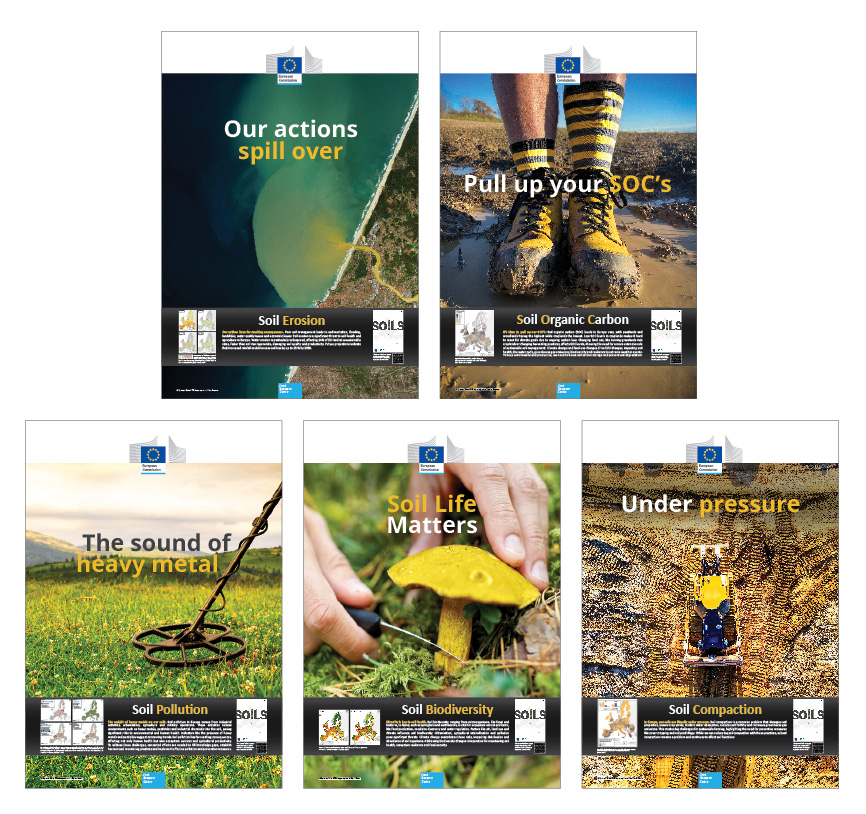
State of Soil Posters
Resource Type: Maps & Documents, Documents, Poster Publications
Year: 2025

Off the back of the State of Soil in Europe Report, which is a major milestone in soil assessment, providing an in-depth examination of the state of soils across Europe. A series of thematic posters have been developed based on the report’s key findings. 


Harmonizing soil pollution data and knowledge in Europe: a collaborative effort towards achieving healthy soils by 2050
Resource Type: Maps & Documents, Documents, Scientific-Technical Reports
Year: 2025

This report addresses soil pollution in the EU, supporting the implementation of the EU's Soil Monitoring Law (SML) and Zero Pollution Action Plan. This document presents the outcomes of workshop with several EU Mission projects on soil pollution, including the SoilWise, ISLANDR, EDAPHOS, ARAGORN, and BENCHMARKS projects. The report provides a comprehensive approach to harmonization and standardization of soil pollution data, essential for effective policy-making and decision-support. The report also provides information on the development of new policy measures, such as the EU's Soil Strategy and proposed Directive on Soil Monitoring and Resilience. This report hopes to serve ongoing and future Soil Mission projects with data harmonization for a higher dissemination and policy impact. The harmonization of the data will help EU and national/regional policymakers to have a clear view on the state of the soil pollution and therefore reinforce their regulation on soils (e.g., Soil Monitoring Law).

Download the report

Status of Environment and Climate in Ukraine
Resource Type: Documents, Scientific-Technical Reports, Maps & Documents
Year: 2025

The present report provides an overall picture of the status of environment and climate - air quality, emissions of air pollutants and greenhouse gases - (GHG), forests, soil and marine environment in Ukraine. The analysis is based on available studies by JRC and other sources. However, the report does not cover all environmental areas as completeness and quality of data varies across the different topics. The ongoing conflict between Russia and Ukraine has exacerbated pre-existing challenges related to environmental monitoring and the enforcement of environmental regulations, further complicating this assessment.

The information summarised in this study provides for the first time the basis for assessing the impact of war in Ukraine with reference to specific environment and climate aspects, including relevant elements for the reconstruction of the country. Moreover, the report provides additional information for benchmarking the EU accession process of Ukraine, with particular reference to Chapter 27 of the EU Acquis on Environment, as well as for monitoring the progress in the green transition, with an emphasis on zero-pollution, low-carbon and nature-preserving dimensions.

In the last decade, Ukraine made efforts to align its environmental strategy with EU standards including the definition of key strategic goals and a roadmap for its participation in the Green Deal. The concentration of pollutants regulated by Ukrainian legislation meet the EU criteria, with the exception of NO2 and CH2O. National standards for atmospheric particulate matter with diameter <2.5 μm and <10 μm (PM2.5 and PM10, respectively) are not in place yet. Emission of pollutants have decreased over the past decade due to the impact of COVID-19 pandemic and the war.


Over the past decade, climate change and the war have significantly increased the risk of large forest fires, with the worst situation in the last five years. Wildfires account for 45-65% of the total forest cover losses every year. Although soils in Ukraine contain high levels of organic matter and nutrients, they are also vulnerable to degradation, such as nutrient mismanagement, acidification, erosion, compaction, salinisation, contamination. Erosion is the most widespread threat since it affects 40% of the Ukrainian soil.

Download the report

EUSO annual report 2024
Resource Type: Documents, Scientific-Technical Reports, Maps & Documents
Year: 2025

Healthy soils are essential for providing healthy food and achieving climate neutrality. The publication of the EU Soil Strategy for 2030, the proposed Soil Monitoring and Resilience Directive and the Mission Soil marked major milestones for soil protection and restoration in the EU. Given this context, the EU Soil Observatory (EUSO) aims to be the principal provider of knowledge and data on soils at the EU-level and to underpin EU policies related to soils. This report highlights the main activities and outcomes of the EUSO in 2024. During this period, the EUSO provided policy support to a wide range of soil related areas, including the proposed Soil Monitoring and Resilience Directive, the Carbon Removal Certification Framework and the Mission Soil. A highlight was the launch of the science for policy report ‘The state of soils in Europe’, in collaboration with the European Environment Agency, providing an in-depth examination of the pressures affecting soils across Europe. Furthermore, the EUSO updated its Soil Degradation Dashboard and launched a novel EU Soil Strategy Actions Tracker. The latter shows that almost 70% of the policy actions listed in the EU Soil Strategy for 2030 are completed. Next, the European Soil Data Centre, the leading web platform for sharing data and knowledge about EU soils, has grown significantly with 15 new datasets and a 20% increase in requests for datasets. Additionally, the EUSO contributed directly to advanced scientific knowledge on soils with the publication of 47 scientific papers, 10 technical reports, and 3 science-for-policy reports. Finally, the EUSO organised and contributed to activities to support stakeholder interactions and citizen engagement regarding soils. Highlights include the fourth EUSO Stakeholders Forum, the second Young Soil Researchers Forum, the European Mission Soil Week and the activities of the EUSO Working Groups. During 2025, the EUSO will continue to be the principal provider of soil-related data and knowledge while supporting the implementation of EU policy objectives in relation to soils.

Download the Report: https://esdac.jrc.ec.europa.eu/public_path//shared_folder/doc_pub/JRC141262.pdf

Delivering the EU Green Deal - Progress towards targets
Resource Type: Maps & Documents, Documents, Scientific-Technical Reports
Year: 2025

The study shows that significant achievement has been delivered so far but progress needs to accelerate in many areas. As of mid-2024, 32 of the 154 targets are currently “on track” and 64 are identified as “acceleration needed” meaning that more progress is needed to meet the targets on time. Furthermore, 15 of the targets are found to be “not progressing” or “regressing”, and for 43 of the targets no data is currently available. The timing of the binding policies, most of which have been recently agreed and are expected to deliver results in the coming years, is a significant factor influencing these assessments.This report integrates all EGD actions and related policies, offering an assessment of the EU’s green transition based on robust data and science. It identifies priority areas for intensified efforts to meet short-term implementation goals and contribute to the long-term ambition of a sustainable, fair, just, and climate-neutral Europe by 2050. This collective work serves as a benchmarking tool, providing scientifically grounded guidance for future EU policies and programmes.

Link to the report: https://publications.jrc.ec.europa.eu/repository/handle/JRC140372

SOLACE - Understanding the links between SOiL pollution and CancEr
Resource Type: Documents, Scientific-Technical Reports, Maps & Documents
Year: 2025

Soil pollution is a significant environmental and health concern in Europe, with potential links to cancer incidence. The Exploratory Research project “Understanding the links between SOil pollution and CancEr” (SOLACE)” aimed to investigate the complex relationships between soil properties, pollution, land use and human health, providing a foundation for further research and policy development, as part of the Joint Research Centre's (JRC) strategic scientific development.. The scoping review of the existing studies linking soil pollution and cancer identified the knowledge gaps in the fields. We also performed an ecological study across 26 EU countries, which releaved associations between the regional rates of lung cancer mortality and soil pollution with arsenic and cadmium. The SOLACE project underscores the importance of comprehensive soil monitoring to safeguard environmental and human health and emphasizes the need for continued investment in research, monitoring, and policy development to address the complex issues surrounding soil pollution and its impact on human health The SOLACE project achievements contribute to the goals of the JRC by supporting soil-related directives like the Soil Monitoring Law and the Zero Pollution Action Plan.

Download the report

EU Soil Strategy Actions Tracker
Resource Type: Maps & Documents, Documents, Scientific-Technical Reports
Year: 2025

The EU Soil Strategy for 2030 sets out a framework to ensure that soils are used sustainably by setting concrete measures to protect and restore soils. It sets a vision and objectives to achieve healthy soil by 2050, with concrete actions due by 2030. The newly developed ‘EU Soil Strategy Actions Tracker’ is a tool to track the progress of these concrete actions since the adoption of the EU Soil Strategy in 2021. The EU Soil Strategy Actions Tracker provides an overview on the status of the actions, information on the due date, recent updates, links to related EU policies, links to relevant sources, and the main actors responsible for implementation. Currently, 62 out of 90 actions (69%) are marked as completed, 24 actions (27%) as in progress, and 4 actions (4%) as withdrawn. The EU Soil Strategy Actions Tracker provides a clear overview of the progress made by the European Commission under the EU Soil Strategy. With almost 70% of complete actions, the tracker shows that the Commission is well on track to complete most of the actions included in the EU Soil Strategy. Together with the EU Soil Observatory (EUSO) Soil Degradation Dashboard, it provides an informative overview on EU soil health status and ongoing actions to preserve and restore the state of soils in the EU. The EU Soil Strategy Actions Tracker is the first step towards an EUSO Soil Policy Actions Tracker to monitor EU policy actions relevant to soils, other policies (e.g. EU Climate Law) are foreseen to be included in 2025.